
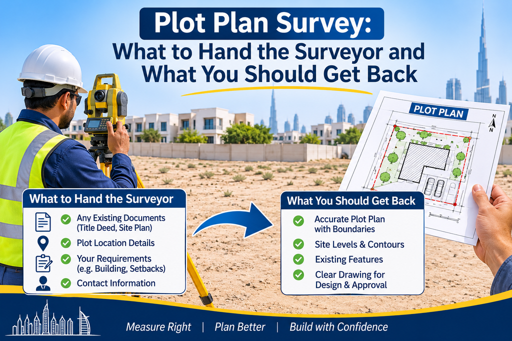
Ask five people what a plot plan survey is and you will hear five answers. Some mean a boundary check. Others mean a drawing for the architect. A few mean the paperwork for an approval. In practice, a plot plan survey is a field survey of your plot that ends in one clear drawing: the boundary, the levels, and everything already standing on the land. Your designer then uses that drawing to plan the building.
This guide covers the practical side. You will see when you need one, what to prepare, how the team works on site, what the finished drawing should show, and how to check it before you rely on it. If you want the wider picture first, start with our guide to what a plot survey covers and when you need one.
What a Plot Plan Survey Means for Your Project
A plot plan survey records the plot as it stands today and presents it as a drawing. The surveyor measures on site with a total station and GNSS equipment, then draws the result in CAD. That drawing becomes the base for the plot plan, which shows what you intend to build.
Think of it as the starting file for your design. The building footprint, setbacks, access and parking all sit on top of it. If the base is wrong, every layer above it is wrong too. Our plot survey service page lists what we record on a typical plot.
Situations That Call for a Plot Plan Survey
Most owners order one at one of these points:
- Before design starts on a new villa, building or warehouse
- Before an extension, annex or boundary wall on an existing property
- When you buy a plot and want to confirm its size and shape
- When you split or merge plots
- When neighbours disagree about the boundary, often together with demarcation
- At completion, when an as-built survey compares what the contractor built with the approved plan
What to Prepare Before the Survey Team Arrives
The team can start with very little, but a few items save time and avoid repeat visits.
| Item | Why it helps |
|---|---|
| Plot number and location, or a title deed copy | Lets the surveyor identify the right plot and its recorded boundary |
| Any earlier survey or site plan | Gives the team a record to compare against |
| Your designer’s brief or rough sketch | Shows which areas of the plot matter most |
| Master developer or authority guidelines, if any | Tells the team which drawing format and details to expect |
| Site access and a contact person | Saves a wasted trip |
| Notes on known issues, such as a leaning wall or a shared fence | Directs extra attention to them |
If you have none of these, call us anyway. We can start from the plot number and a site visit.
How the Survey Team Works on Site
A typical plot follows these steps:
- Site visit : The team confirms the plot against its number and any reference documents.
- Control setup : Surveyors fix control points so every measurement ties to one framework.
- Field measurement :The team measures boundary corners, ground levels, structures, kerbs, roads and visible utilities with a total station and GPS survey equipment.
- Checks : Surveyors repeat key measurements to catch errors before they leave the site.
- Drawing : The office team turns the field data into a CAD drawing with levels and notes.
A surface survey cannot see underground pipes or cables. If your plot may hold buried services, add a utility survey.
What the Finished Drawing Should Show
A useful plot plan survey drawing normally includes:
- The plot boundary with dimensions and corner points
- The measured plot area
- Ground levels and contours, which come from a topographic survey and help with drainage and earthwork planning
- Existing buildings, walls, gates and fences
- Adjacent roads, kerbs, footpaths and access points
- Visible utilities such as manholes, poles and covers
- A north arrow, scale, coordinate system and survey date
The survey date matters more than people expect. A plot changes over time, so a drawing from three years ago may not describe the plot today.
Factors That Affect Cost and Turnaround
Price and time depend on the job, so give the surveyor these details when you ask for a quote:
| Factor | Effect on cost and time |
|---|---|
| Plot size | A larger plot needs more field time |
| Access and obstacles | Dense vegetation, debris or locked gates slow the work |
| Scope | A boundary-only survey takes less time than one with levels and utilities |
| Drawing format and copies | CAD files, PDFs and printed sets add office time |
| Urgency | A short deadline can change how the team schedules the work |
A small, open, clear plot sits at the quick end. A large, overgrown plot with several structures takes longer.
Reviewing the Drawing Before You Design or Submit
Read the drawing before you hand it on. Five checks catch most problems:
- Compare the plot area and dimensions with your title deed or site plan. A small mismatch deserves a question.
- Check that the boundary lines match the corners you saw on site.
- Look at the levels near the road and the neighbouring plots, because they drive drainage and floor levels.
- Confirm the drawing shows every existing structure you know about.
- Check the survey date and coordinate system so your design team works from the right base.
Our article on what your plot survey map is telling you about your land explains these details further.
Once the drawing passes your checks, your designer builds the plot plan on it. Setting out later transfers the approved layout to the ground, and the structural drawings follow, as our piece on how an AutoCAD structural drawing takes shape shows.
Approvals depend on the plot. Dubai Municipality or the master developer usually sets the rules, so ask your consultant which drawings the authority wants with your submission.
Getting the Base Right Before the Design Starts
A plot plan survey costs little compared with the work that depends on it. The designer, the structural engineer and the contractor all start from the same drawing, so accuracy at this stage protects every later stage.
If you have a plot and a project in mind, contact our team and we will tell you which survey fits. You can also read more about our wider services on our land surveying in Dubai page.
Frequently Asked Questions
1. What is a plot plan survey?
It is a field survey of a plot that ends in a drawing of the boundary, levels and existing features. The designer uses that drawing as the base for the plot plan.
2. How long does a plot plan survey take?
It depends on plot size, access and scope. A small, clear plot is quick, while a large or crowded plot takes longer. Ask for an estimate and share the details in the table above.
3. Do I need a plot plan survey if I already have a site plan?
Usually yes, A site plan from the authority shows approved planning details, but it does not record today’s ground levels or the structures standing on the plot.
4. Can I reuse an old survey?
You can if nothing on the plot has changed, but check the survey date first. A fresh survey is safer when you are about to start a design.
5. What should I give the surveyor?
The plot number or title deed, any earlier drawings, your designer’s brief and a site contact. Missing items do not stop the work, but they speed it up.