Satelite survey | Photogrammetry | GPS Survey UAE
Get accurate satellite survey, photogrammetry, and GPS survey solutions for your projects in UAE.
Efficient Precision, Anywhere
Field surveys often involve slow, error-prone processes. Our GPS services use GNSS technology to quickly deliver high-accuracy data, even in challenging environments. Northern Engineering Survey ensures reliable spatial data collection, enabling faster decision-making and more precise execution, which accelerates project timelines and reduces operational risk.

Other Related Services

Mobile-Mapping

Utility-Survey

Cadastral-Survey
Company Profile
Our Business Statistics
Why Choose Us
High-Tech Total
Stations
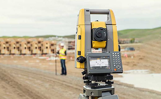
Utilizing high-precision total stations, we achieve sub-millimeter accuracy with automated measurements and error-free data transfer for reliable, fast setups.
Seamless Data Integration
Our surveying and CAD services integrate flawlessly, ensuring maximum data integrity, eliminating loss, and delivering reliable, accurate results for smooth project execution.
Proven Experience & Expertise
Expertise Northern Engineering Survey boasts a comprehensive portfolio of successful projects, reflecting high client satisfaction and a trusted industry reputation for quality.
Tailored Project Solutions
We offer bespoke solutions supporting precise site planning for construction, land/Environmental assessments, and optimized municipal/urban planning.
Hear From Our Clients
NES Dubai showcases a diverse range of completed projects, indicating their expertise and rel“Professional, Prompt, and Precise!”
We’ve worked with NESDubai on multiple residential projects across the UAE. Their consistent quality and use of modern equipment set them apart from other survey firms.
“Trusted Survey Partner for Our Developments” — Omar Khalid, Director.Their BIM modeling and control point services helped us streamline our structural planning process. Communication was clear throughout the project. Will definitely work with them again.
“Highly Accurate and Detailed Surveys” — Lina Haddad, Structural Engineer.From GPS surveys to setting out for our commercial site, NESDubai’s team was on point. Their quick turnaround and technical expertise saved us both time and cost.
.“Reliable, Responsive, and Results-Driven” — James Brooks, Site Manager.GPS-Survey FAQ
What is GPS Surveying?
GPS (Global Positioning System) surveying is a modern land measurement technique that uses signals from a network of orbiting satellites (GNSS) to accurately determine the precise three-dimensional position of points on the Earth’s surface.
What are the main advantages of GPS surveying over traditional methods?
surveying offers several benefits, including significantly higher efficiency and speed, the ability to survey points without requiring a clear line-of-sight between them, all-weather operability, and generally lower labor costs for large projects compared to conventional surveying.
Can GPS surveying be done in areas with obstructions like buildings or trees?
While dense urban areas or heavy tree cover can challenge traditional GPS signal reception, advanced GPS survey equipment like IMU-integrated GNSS receivers and robotic total stations are used to overcome these limitations. These technologies ensure precise data collection and continuity even in challenging environments.
What kind of equipment is used in GPS surveying?
Key equipment includes GNSS receivers (which capture satellite signals), various types of antennas, data collectors/controllers, and often a base station for differential corrections. For high precision and challenging conditions, RTK systems, IMU-integrated GNSS receivers, and robotic total stations are commonly deployed.
What are the common applications of GPS surveying?
GPS surveying is widely used for diverse applications, including topographic mapping, construction layout and stakeout, cadastral (property boundary) surveys, infrastructure monitoring, volume calculations, utility mapping, and establishing precise control networks for other survey activities.
NES Dubai handled all our demarcation and as-built survey requirements perfectly. Their team was knowledgeable and ensured everything was approved by Dubai Municipality without delays.
“Excellent Service for Construction Permits” — Fatima Al Suwaidi, Architect.