
A plot looks simple from the roadside. A boundary wall, some sand, maybe a corner peg somebody left years ago. The trouble starts when two documents describe that same plot and nobody is sure which one to trust. One is the land survey. The other is the plot plan.
People often use the two terms as if they mean the same thing, and a request for a land survey plot plan usually joins them into a single phrase. They are closely related, but they do different jobs. This article separates them, shows how one feeds the other, and explains where projects in Dubai tend to go wrong between the two.
Understanding the Land Survey Plot Plan
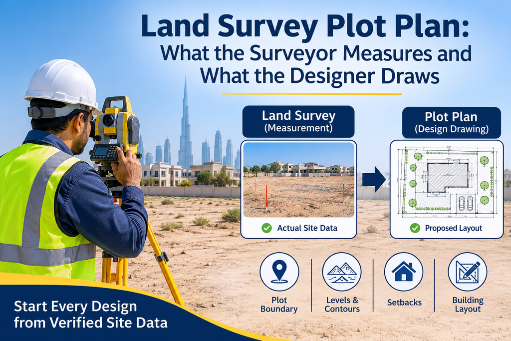
The phrase covers two pieces of work. The land survey is the measurement: a survey team visits the plot and records what is actually there. The plot plan is the drawing: it shows the plot boundary and what is proposed on it, such as the building footprint, access, parking and open areas.
When a client asks for a land survey plot plan, they usually want the drawing to rest on measured site data, not on assumptions or old records. If you want the measuring side explained in full, our plot survey service page covers what we record and how it is delivered.
Land Survey and Plot Plan: Two Documents with Distinct Purposes
The easiest way to keep them apart is to ask what question each one answers.
| Land survey | Plot plan | |
| Question it answers | What is on this plot today? | What will be built on this plot? |
| Prepared by | Surveyor | Architect or designer |
| Based on | Field measurement | The survey, plus the design brief |
| Shows | Boundaries, levels, existing features | Proposed layout, setbacks, access, parking |
The survey describes the present. The plot plan describes the intention. A plot plan drawn without a survey is only as reliable as whatever the designer was handed.
Site Data Captured During a Land Survey
On site, the surveyor works with a total station and GNSS equipment to record the plot in coordinates and levels. A typical set of data includes:
- Plot corners and boundary lines as they exist on the ground
- Ground levels and contours, which is the work of a topographic survey
- Existing structures, walls, kerbs, roads and access points
- Visible utilities such as manholes, poles and covers
Open plots are often covered quickly with GPS survey methods, while tighter sites need a total station. Where underground services are a concern, a surface survey cannot see them, so a separate utility survey fills that gap.
Design Information Shown on a Plot Plan
The plot plan is where the designer puts the idea on paper. It normally shows the building footprint, the setbacks from the boundary, entrances and driveways, parking, open or landscaped areas, and the points where services will connect.
It is a planning drawing, so it is simpler than a full construction set. Once the plot plan is settled, detailed drawings follow. If you are curious how that next stage works, we explained it in how an AutoCAD structural drawing gets made.
How Survey Data Forms the Base of the Plot Plan
The survey normally reaches the designer as a CAD drawing. The designer places the proposed layout over it, so the boundary, the existing levels and any fixed features in the plot plan come straight from the field data.
This works well when the survey is tied to proper control points. With a shared control framework, drawings from the architect, the structural engineer and the services consultant overlay correctly. Without it, small differences between consultants add up.
The delivered survey record is also worth keeping and reading carefully. Our piece on what your plot survey map is telling you about your land shows what to look for once it lands in your inbox.
Common Discrepancies in Boundaries, Setbacks and Levels
Most problems between a survey and a plot plan fall into three groups.
Boundaries. A fence or wall is taken as the plot line, but the recorded boundary sits somewhere else. The design then starts from the wrong edge.
Setbacks. Setbacks are measured from the boundary. If the boundary is off, every setback is off with it, even though the drawing looks neat.
Levels. A design assumes a road or ground level that has since changed, so floor levels, drainage and access slopes no longer fit the site.
Any of these can force a redesign or a resubmission. Demarcation puts the recorded plot corners on the ground, so the boundary stops being a matter of opinion before the design begins.
Using Both Documents for Dubai Authority Approvals
In Dubai, approvals run through the relevant authority for the plot, which is often Dubai Municipality or the master developer in a planned community. The details differ from plot to plot, but the principle stays the same: the drawings you submit should agree with the plot’s recorded boundaries and approved site plan.
A sensible sequence looks like this:
- Commission the land survey before design work starts.
- Check the plot plan against the survey and the site plan before submission.
- Use setting out to transfer the approved layout from drawing to ground.
- Confirm what was built with an as-built survey at completion.
If you are earlier in the process and still deciding what you need, our guide to what a plot survey covers and when you need one is a good place to start, and our land surveying in Dubai page lists the wider services.
Starting Every Design from Verified Site Data
A land survey and a plot plan are not rivals. The survey tells you what the plot is, and the plot plan tells you what you intend to do with it. When the second is drawn from the first, most of the common delays never happen.
If you have a plot and a design in mind, contact our team and we will help you work out which survey the project needs.
Frequently Asked Questions
1. Is a land survey the same as a plot plan? No. A land survey measures the plot as it stands on site. A plot plan is a drawing that shows the plot with the proposed layout on it.
2. Which one comes first? The land survey. The plot plan is drawn from the surveyed boundaries, levels and existing features.
3. Can a designer prepare a plot plan without a new survey? They can work from old drawings, but those may not match the site as it is today. A fresh survey removes that risk.
4. What does a land survey plot plan usually show? Typically the plot boundary, dimensions, levels, existing structures, and setbacks. The exact content depends on the project and the authority involved.
5. Why do mismatches between the two cause delays? When the drawing and the site disagree on boundaries or levels, the design often has to be revised and resubmitted.