Hydrography Survey UAE | Bathymetric & Marine Survey
Precise bathymetric mapping for safe navigation, port development and marine construction—from sonar and LiDAR data to actionable charts..
Underwater Clarity for Safe Marine Operations
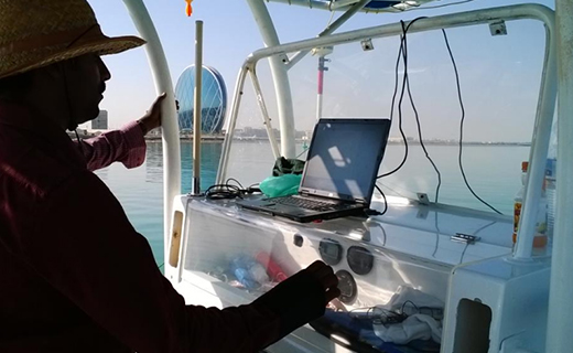
Mapping underwater environments is challenging but essential for safe and efficient marine operations. Our hydrographic surveys use advanced sonar technology to deliver high-resolution bathymetry and obstruction detection. Northern Engineering Survey provides vital subsea data that ensures accurate positioning, safety, and efficient navigation, helping clients meet marine infrastructure challenges with confidence.

Other Services

Oceanographic survey

BIM Modeling

Drone Mapping
Company Profile
Our Business Statistics
Why Choose Us
High-Tech Total
Stations
Utilizing high-precision total stations, we achieve sub-millimeter accuracy with automated measurements and error-free data transfer for reliable, fast setups.
Seamless Data Integration
Our surveying and CAD services integrate flawlessly, ensuring maximum data integrity, eliminating loss, and delivering reliable, accurate results for smooth project execution.
Proven Experience & Expertise
Expertise Northern Engineering Survey boasts a comprehensive portfolio of successful projects, reflecting high client satisfaction and a trusted industry reputation for quality.
Tailored Project Solutions
We offer bespoke solutions supporting precise site planning for construction, land/Environmental assessments, and optimized municipal/urban planning.
Hear From Our Clients
NES Dubai showcases a diverse range of completed projects, indicating their expertise and rel“Professional, Prompt, and Precise!”
We’ve worked with NESDubai on multiple residential projects across the UAE. Their consistent quality and use of modern equipment set them apart from other survey firms.
“Trusted Survey Partner for Our Developments” — Omar Khalid, Director.Their BIM modeling and control point services helped us streamline our structural planning process. Communication was clear throughout the project. Will definitely work with them again.
“Highly Accurate and Detailed Surveys” — Lina Haddad, Structural Engineer.From GPS surveys to setting out for our commercial site, NESDubai’s team was on point. Their quick turnaround and technical expertise saved us both time and cost.
.“Reliable, Responsive, and Results-Driven” — James Brooks, Site Manager.Hydrography Survey FAQ
What is the purpose of a Hydrography survey?
Hydrography surveys map underwater terrain to support safe navigation, aid marine construction planning, and facilitate environmental monitoring of aquatic ecosystems.
How is bathymetric data collected?
Data is collected using echo sounders to measure water depths, combined with GPS/GNSS for precise positional information. Ancillary sensors also record sound velocity and vessel motion for accuracy.
Can surveys be done in rivers, lakes, and coastal areas?
Yes, bathymetric surveys are highly adaptable and can be effectively performed in rivers, lakes, and coastal areas, with methodologies adjusted for specific environmental conditions.
Is the data affected by tides and waves?
Yes, data is affected by tides and waves, but corrections are applied using tidal observations and advanced motion sensors to ensure accurate depth measurements.
Who typically needs a bathymetric survey?
Key users include ports and harbors, dredging contractors, marine engineers, and environmental agencies, all requiring detailed underwater mapping for their operations and management.
NES Dubai handled all our demarcation and as-built survey requirements perfectly. Their team was knowledgeable and ensured everything was approved by Dubai Municipality without delays.
“Excellent Service for Construction Permits” — Fatima Al Suwaidi, Architect.