
Topographic Survey: How Survey Plans Support Better Site Design
Introduction
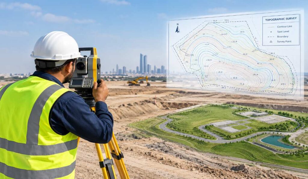
Before construction begins, understanding the land is essential for effective site planning. A topographic survey records ground levels, existing structures and terrain features, helping architects and engineers make informed design decisions. The resulting topographic survey drawing provides a clear reference for site layout, drainage and earthwork planning.
What Is a Topographic Survey?
A topographic survey measures a site’s ground levels, elevations and existing features, including roads, buildings, drainage elements and trees. Surveyors use equipment such as total stations, GNSS receivers or laser scanners to collect accurate site data.
The results are used to prepare survey drawings and terrain models that help engineers assess ground conditions, plan drainage and determine suitable building levels before construction begins.
What Is a Topographic Map Used For?
A topographic map is used to understand the shape, elevation and physical characteristics of a surveyed area. It gives project teams a clearer picture of how the existing land relates to proposed development.
Its practical uses include the following.
1. Site Layout and Building Design
Architects and engineers use survey information to position proposed structures in relation to existing ground levels, access routes and surrounding features. This helps them assess how a building layout fits within the available site.
2. Road and Access Planning
Ground elevations and existing road levels help engineers assess site access, road alignment and changes in gradient. This information is particularly useful where a development connects to an existing road network.
3. Drainage Design
Ground levels influence the direction in which surface water naturally flows. Survey data helps engineers identify low points, changes in slope and areas that may require careful drainage planning.
A topographic survey supports this assessment, although drainage design also requires engineering calculations and other project-specific information.
4. Earthwork Estimation
Existing ground levels provide a reference for comparing the current terrain with proposed design levels. Engineers can use suitable survey data and design surfaces to estimate excavation and filling quantities.
5. Infrastructure and Utility Coordination
Existing surface features and surveyed utility information can help project teams coordinate roads, drainage networks and other infrastructure. Underground utilities should be verified through appropriate utility detection or investigation methods rather than assumed from surface information alone.
What Does a Topographic Survey Drawing Include?
A topographic survey drawing presents the measurements and site features in a format that design and construction teams can interpret. Its contents depend on the survey scope and the intended use of the information.
Common elements include:
- Spot levels: Elevation values recorded at specific points across the site.
- Contour lines: Lines connecting locations with the same elevation.
- Existing structures: Building outlines, walls, kerbs and other relevant constructed features.
- Roads and access points: Road edges, pavements, entrances and related site details where included in the survey scope.
- Drainage features: Visible manholes, gullies, channels and other surveyed drainage elements.
- Boundary information: Plot boundaries or boundary references where included and established by the appropriate survey.
- Coordinates and benchmarks: Reference information used to locate survey points and interpret elevations.
- Drawing legend and scale: Information that explains the symbols, measurements and representation used in the drawing.
A well-prepared drawing should also identify the relevant units, coordinate reference system and elevation datum. These details help prevent confusion when the survey information is transferred into design software or compared with other project drawings.
Depending on the requirements, deliverables may include PDF drawings, CAD files and digital terrain data.
How Is a Topographic Plan Used in Project Planning?
A topographic plan is a scaled representation of the surveyed site, showing its existing features and levels. It provides a working reference for assessing the land before proposed layouts are finalised.
For example, a developer planning a residential project may need to understand the relationship between the building footprint, driveway, adjoining road and drainage arrangements.
The design team can use the topographic plan to:
- Review the available site area and existing physical constraints.
- Compare proposed building positions with measured ground levels.
- Assess access arrangements and changes in elevation.
- Develop grading and drainage proposals using the surveyed terrain.
- Identify areas where additional measurements or investigation may be required.
The plan can also help different disciplines coordinate their work. An architect may focus on the building layout, while a civil engineer examines grading and drainage. Both can refer to the same surveyed site information.
It is important to distinguish existing survey information from proposed design levels. A topographic plan records the conditions captured during the survey; it does not automatically represent the finished design or confirm that a proposed layout has been approved.
Understanding Topographic Lines and Their Role in Design
Topographic lines, particularly contour lines, help represent changes in ground elevation on a two-dimensional drawing.
Each contour line connects points that share the same elevation. The pattern formed by these lines gives engineers and designers a visual indication of the terrain.
What Contour Patterns Tell You
Closely spaced lines
Contour lines that sit close together generally indicate a steeper slope. This may require additional attention when planning access, grading or earthworks.
Widely spaced lines
Wider spacing generally indicates a gentler slope. The actual gradient still depends on the contour interval and the horizontal distance between the lines.
Closed contour patterns
Closed loops can represent hills or depressions. The elevation labels and contour pattern help establish which feature is present.
Irregular contour patterns
Uneven patterns may indicate changing terrain, local rises and falls or other variations in the ground surface.
Why These Lines Matter
Contour information helps project teams understand how the land changes across the site. This is important when assessing proposed platform levels, road gradients, landscape arrangements and surface drainage.
However, contours should not be interpreted in isolation. Spot levels, surveyed breaklines, benchmarks and other relevant measurements may be needed to understand critical areas accurately.
For detailed engineering work, the survey data should be suitable for the intended design and checked against the project’s required accuracy.
How Topographic Survey Information Helps Reduce Construction Rework
Construction problems sometimes begin when the existing site conditions are not fully understood during design. A drawing prepared without sufficient ground-level information may need to be revised after site work begins.
A reliable topographic survey helps reduce this risk in several ways.
Better Coordination Before Construction
Design teams can compare proposed levels with the surveyed terrain before finalising their drawings. Potential conflicts involving access, grading or existing structures can then be reviewed earlier.
More Informed Earthwork Planning
Comparing existing and proposed terrain helps engineers estimate cut-and-fill requirements. This supports preliminary quantity assessments, equipment planning and construction scheduling.
Clearer Communication Between Teams
A consistent set of survey drawings gives architects, civil engineers and contractors a shared reference for existing site conditions.
Earlier Identification of Site Constraints
Unexpected level changes, physical obstructions or differences between available records and measured conditions can be investigated before they create larger problems.
A survey cannot eliminate every construction risk, but accurate site information gives the project team a stronger basis for planning and coordination.
Choosing the Right Topographic Survey Deliverables
Not every project requires the same level of survey detail. The appropriate deliverables depend on the site, design stage and information the project team needs.
Before commissioning a survey, clarify the following:
- Purpose of the survey: Explain whether the information is required for building design, road works, drainage planning, earthworks or another purpose.
- Required site coverage: Identify the plot and any adjoining areas that need to be surveyed.
- Features to be recorded: Specify relevant structures, road details, drainage features and other site elements.
- Level of detail and accuracy: Confirm the project’s technical requirements with the design team and survey provider.
- File formats: Establish whether CAD drawings, PDFs, coordinate lists or digital terrain models are needed.
- Reference information: Confirm the required coordinate system, elevation datum and survey control.
- Project or authority requirements: Check whether particular drawing formats, survey procedures or submission requirements apply.
Providing these details at the beginning helps the survey team prepare information that is appropriate for the intended use.
Need a Reliable Topographic Survey in Dubai?
Northern Engineering Surveys L.L.C. provides professional topographic surveying services to support site planning, engineering design and construction projects. Contact our team for accurate survey data and detailed drawings tailored to your project requirements.
Get in touch today to discuss your surveying needs.
Website: https://nesdubai.com/
Frequently Asked Questions
1. What is the main purpose of a topographic survey?
The main purpose is to measure and document existing ground elevations and relevant natural and man-made features. The information supports site planning, engineering design, grading, drainage and construction preparation.
2. What is a topographic map used for in construction?
A topographic map helps architects, engineers and contractors understand the existing terrain and site features. It can support building layout, road alignment, drainage planning, earthwork estimates and coordination with existing infrastructure.
3. What is the difference between a topographic survey drawing and a topographic plan?
Both present surveyed site information. A topographic survey drawing is a general term for the drawing produced from survey measurements, while a topographic plan commonly refers to the scaled plan view used for site assessment and design. The exact terminology and contents can vary by project.
4. What information should a topographic survey drawing contain?
Depending on the scope, it may include spot levels, contour lines, existing structures, road features, drainage details, coordinates, benchmarks, a scale and a drawing legend. The required information should be agreed upon before the survey starts.
5. What do topographic lines show?
Contour lines connect points with the same elevation. Their pattern helps show changes in ground height and the general shape of the terrain. Spot levels and other survey data provide additional detail.
6. Are contour lines and topographic lines the same?
The terms are sometimes used interchangeably, but topographic lines can be a broader description of linework on a topographic drawing. Contour lines specifically connect points of equal elevation.