
GPS Survey for Earthworks: Methodology, Equipment and Site Procedures
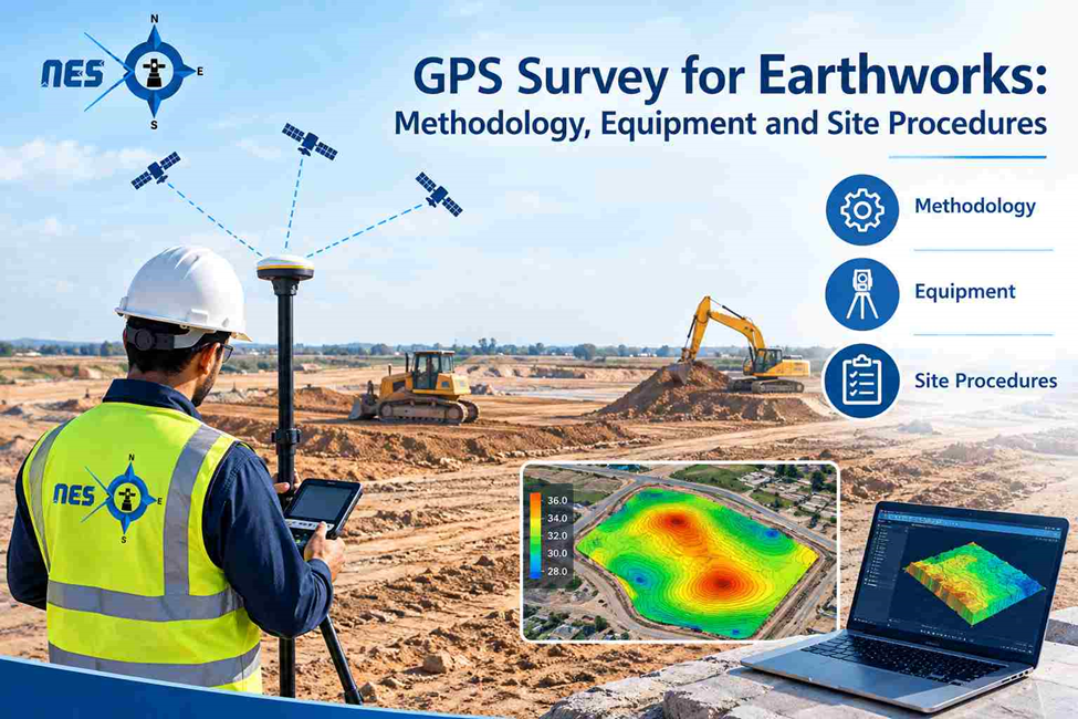
GPS surveys provide accurate coordinate and elevation data for earthworks, helping contractors monitor excavation, filling, and grading against approved design levels. With suitable equipment, verified control points, and a clear survey methodology, site teams can check formation levels and maintain reliable construction records.
What Is a GPS Survey in Earthworks?
A GPS survey uses satellite-based GNSS technology to measure ground coordinates and elevations. On earthworks sites, surveyors collect points across existing terrain, excavation areas, embankments, and formation surfaces to compare actual ground levels with approved design levels.
How GPS Surveying Supports Earthworks Projects
Earthworks usually involve repeated changes to the ground surface. Soil is removed from higher areas, transferred or imported where necessary, and placed in lower areas to achieve the required profile. Survey measurements help the construction team manage these changes throughout the project.
Existing Ground Level Survey
Before earthmoving starts, surveyors collect elevations and coordinates across the work area. The point density depends on the terrain, the required accuracy, and the level of detail needed for the design.
These measurements help create an existing-ground surface that engineers can use for grading plans and earthwork calculations. Additional points may be required around sudden changes in slope, drainage channels, road edges, retaining structures, or other important features.
Excavation and Formation Level Checks
During excavation, surveyors check the depth and extent of the work against the design. They can identify areas where the ground remains above the required formation level or where excavation has gone below the intended level.
These checks help the site team address discrepancies before the next construction activity begins. They are particularly useful when excavation is carried out across a large plot or in several work zones.
Embankment and Filling Surveys
Filling operations require control over both horizontal limits and finished elevations. Surveyors use GPS measurements to check the position of embankments, monitor placed material levels, and verify the completed surface against the design.
Where a project requires several filling stages, measurements can be taken at agreed intervals to document progress. The survey results can then be compared with the relevant design surface or previous survey records.
Cut-and-Fill Volume Calculation
Cut-and-fill calculations estimate the difference between two ground surfaces, such as the existing terrain and the proposed design level. GPS survey data can provide the ground measurements needed to create these surfaces.
Survey software compares the surfaces to calculate excavation and filling quantities. The reliability of the result depends on the quality of the field data, the selected calculation method, the surface boundaries, and the reference levels used.
For payment assessments or contractual quantity verification, the survey scope and calculation procedure should be agreed with the relevant project parties before measurements begin.
GPS Survey Machine: Equipment Used on Earthworks Sites
A GPS survey machine for construction work is generally a survey-grade GNSS receiver used with a controller and supporting equipment. Unlike a handheld navigation device, a survey-grade system is designed to collect coordinate data for engineering and land measurement tasks.
The equipment selected depends on the size of the site, the required accuracy, satellite visibility, and the type of work being carried out.
GNSS Receiver and Rover
The rover is the receiver that the surveyor moves between measurement points. It is commonly mounted on a survey pole and connected to a field controller. With an appropriate correction service and a verified solution, an RTK GNSS rover can provide centimetre-level positioning under suitable conditions.
The rover is used to record existing ground points, check formation levels, measure embankments, and set out positions required for construction.
Base Station or Network RTK Corrections
A base-and-rover setup uses a reference receiver at a known position to provide correction data to the rover. Alternatively, a network RTK service can provide corrections through a suitable data connection.
The survey team selects the method according to site conditions, available control, project requirements, and correction-service coverage. Whichever setup is used, the positioning results must be checked against reliable reference points.
Field Controller and Survey Software
The field controller stores the survey points and displays their coordinates, elevations, and relevant design information. It may also allow the surveyor to compare measured positions with design coordinates or check deviations from target levels.
Survey software is used to process the collected data, create terrain surfaces, compare ground levels, and prepare drawings or earthwork reports.
Supporting Survey Equipment
Survey poles, tripods, batteries, communication devices, and suitable accessories are part of the working setup. Depending on the project, a total station may also be required where satellite signals are obstructed or where the task calls for a different measurement method.
The GPS survey machine alone does not guarantee an accurate result. Correct instrument settings, control points, field procedures, and independent checks remain essential.
GPS Survey Method Statement: What Should It Include?
A GPS survey method statement describes how the survey work will be carried out on a project. It sets out the equipment, control procedures, field activities, quality checks, safety measures, and deliverables that the survey team will follow.
For earthworks, the method statement should reflect the actual site conditions and the project’s technical requirements rather than rely on a generic procedure.
1. Scope of Survey Work
The document should define the areas to be surveyed and the purpose of the measurements. This may include an existing-ground survey, excavation checks, formation-level verification, embankment surveys, or final as-built measurements.
The survey limits, required point coverage, tolerances, and expected outputs should be identified before fieldwork begins.
2. Drawings and Reference Information
The survey team should review the latest approved drawings, design surfaces, coordinate schedules, project specifications, and relevant survey control information.
The applicable coordinate reference system, horizontal datum, vertical datum, units, and benchmark information must be confirmed. This prevents inconsistencies between field measurements and engineering drawings.
3. Equipment and Calibration Checks
The method statement should identify the GNSS receiver, rover, controller, correction source, and any supporting instruments. Equipment should be checked before use, and relevant calibration or verification records should be maintained as required by the project.
The team should also confirm that the field software contains the correct coordinate system and design data.
4. Establishing and Verifying Survey Control
Survey measurements must be tied to the project’s approved control network. The surveyor should verify the equipment against known control points before collecting production data.
Where required, additional control points should be established using the specified survey procedure. Control points must be suitably located, protected from disturbance, and documented for future use.
5. Field Data Collection
The method statement should explain how survey points will be selected and recorded. For earthworks, this includes the collection of ground levels, slope changes, excavation limits, breaklines, and other features that influence the ground surface.
The point spacing should be appropriate for the terrain and the intended calculation. A uniform grid may work for relatively consistent ground, while irregular terrain may require additional measurements around changes in elevation.
6. Quality Control and Data Validation
Quality checks should be carried out during the survey, not left entirely until the office-processing stage. The surveyor should check positioning status, repeat critical observations where required, and verify selected points against independent control.
During processing, the team should review missing points, inconsistent elevations, incorrect codes, coordinate-system settings, and unusual surface changes. Any discrepancies should be investigated before the data is issued.
7. Safety and Site Coordination
Earthworks surveys often take place near excavators, dump trucks, graders, compactors, and moving material. The survey team must coordinate with site supervision, follow access restrictions, wear the required personal protective equipment, and remain outside equipment operating zones.
The work sequence should also be coordinated with the construction team so that surveyors can measure the required areas safely without disrupting active operations.
8. Deliverables and Reporting
The method statement should identify the files and records to be submitted. Depending on the scope, these may include survey point files, coordinate reports, CAD drawings, ground surface models, formation-level checks, cut-and-fill calculations, and as-built survey information.
The report should identify the survey date, reference system, relevant control information, calculation basis, and any limitations that affect interpretation of the results.
GPS Survey Methodology for Earthworks
The GPS survey methodology for earthworks describes the sequence followed to collect, check, process, and report survey information. The exact procedure varies with the contract, site layout, and design requirements, but the following stages form a practical workflow.
Stage 1: Review the Design and Survey Requirements
The survey team begins by reviewing the approved earthworks drawings, existing-ground information, proposed levels, slope requirements, and excavation or filling boundaries.
This review identifies which areas require measurements and what the finished survey must demonstrate. It also helps determine whether the work requires a general terrain survey, detailed level checks, volume calculations, or a combination of these activities.
Stage 2: Verify the Site Control
Before taking measurements, the surveyor checks the available control points and confirms that the project coordinate and elevation systems are correctly configured.
Known points are observed to confirm that the equipment produces results consistent with the accepted reference data. If the checks reveal a discrepancy, the cause should be investigated before the survey proceeds.
Stage 3: Collect Existing Ground Data
The surveyor moves through the work area and records the required ground points using the GNSS rover. The measurements should represent the terrain accurately enough for the intended design checks and calculations.
Points are collected along important ground features, including changes in slope, ridges, drainage paths, excavation edges, and other breaks in the terrain. Additional observations may be needed where the surface changes quickly.
Stage 4: Transfer and Process the Measurements
Once fieldwork is complete, the survey data is transferred to the relevant processing software. The team checks the coordinates, elevations, point descriptions, and survey reference settings before creating the ground surface.
Unusual measurements should be reviewed against field records or additional observations. The aim is to produce a surface that reflects the measured site conditions, not simply a model generated from every recorded point without inspection.
Stage 5: Compare Existing and Design Surfaces
For earthwork monitoring, the measured ground surface can be compared with the approved design surface or another agreed reference surface.
The comparison identifies areas that require further excavation, additional filling, or correction of the finished level. Depending on the project, the results may be presented through level-difference reports, surface comparisons, sections, or colour-coded drawings.
Stage 6: Calculate and Review Earthwork Quantities
Where volume calculations are required, the surveyor or engineer compares the relevant surfaces within the agreed calculation boundary. The resulting cut-and-fill quantities should be checked against the project’s specified calculation method.
The report should clearly state which surfaces and boundaries were used, along with the survey dates where comparisons involve measurements from different stages of construction.
Stage 7: Issue the Survey Report
The final data is submitted to the responsible project team for review and use. The deliverables may include CAD drawings, coordinate files, level-check reports, digital terrain models, or earthwork volume summaries.
For ongoing projects, consistent file naming, survey dates, revision control, and reference information help contractors and consultants compare results across different stages of the work.
Need GPS Survey Support for Your Construction Project?
Northern Engineering Surveys L.L.C. provides land surveying and construction survey support for projects across Dubai and the UAE. Survey requirements can be assessed according to the site conditions, design information, and project deliverables.
For GPS surveying, earthworks level checks, topographic surveys, and construction setting out, contact the NES team to discuss your project requirements.
Frequently Asked Questions
1. What is a GPS survey used for in earthworks?
A GPS survey is used to measure ground coordinates and elevations for excavation, filling, grading, embankment construction, and formation-level checks. The collected data can also support terrain modelling and cut-and-fill volume calculations.
2. What is included in a GPS survey method statement?
A GPS survey method statement normally covers the scope of work, approved drawings, equipment, coordinate reference system, control-point verification, field data collection, quality control, safety procedures, and required deliverables. The final document should follow the project’s specifications and approval requirements.
3. What is the GPS survey methodology for earthworks?
The methodology generally involves reviewing the design, verifying survey control, collecting ground measurements, processing the data, comparing existing and design surfaces, calculating quantities where required, and submitting the survey report.
4. Which GPS survey machine is suitable for construction earthworks?
A survey-grade GNSS receiver with RTK capability is commonly used for earthworks on open sites. The selection depends on the required accuracy, satellite visibility, correction-service availability, project specifications, and compatibility with the survey team’s field and processing software.
5. Can GPS surveying be used for cut-and-fill calculations?
Yes. GPS measurements can be used to create existing-ground and subsequent survey surfaces. These can be compared with a proposed design surface to calculate cut-and-fill quantities, provided the survey coverage, surface boundaries, and calculation method are suitable for the project.
6. How often should earthwork levels be surveyed?
The frequency depends on the construction programme, size of the work area, rate of ground changes, inspection requirements, and contractual specifications. Surveys may be required before excavation, at agreed progress stages, after filling or grading, and at completion.
7. Is GPS surveying better than a total station for earthworks?
Neither method is best for every situation. GNSS is efficient across large open areas, while a total station is useful where satellite signals are blocked or detailed measurements require a different setup. Survey teams often combine both methods on the same project.
8. What deliverables can be provided after a GPS earthworks survey?
Depending on the agreed scope, deliverables can include coordinate data, survey point files, CAD drawings, existing-ground and finished-level surfaces, formation-level reports, cross-sections, and cut-and-fill volume calculations. The required formats should be confirmed before the survey begins.