
Highway As-Built Survey: Road Levels, Alignment and Final Records
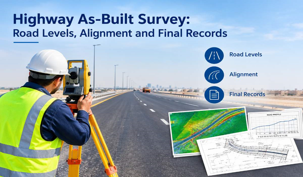
A highway as-built survey records the actual condition of a completed road, including its alignment, pavement levels, road edges, drainage structures and other infrastructure features. It helps consultants and contractors verify completed works against design drawings and maintain accurate records for project handover, future maintenance and infrastructure improvements.
What Is a Highway As-Built Survey?
A highway as-built survey records the actual positions, elevations and dimensions of a completed road, including its alignment, pavement levels, kerbs, medians, junctions and drainage structures. Unlike a road setting-out survey, which guides construction, an as-built survey measures the finished work and compares it with approved design drawings and project specifications. These records support construction verification, project handover, asset management and future road maintenance.
Why Are As-Built Surveys Important for Highway Projects?
Highway construction involves several activities that must work together, from earthworks and pavement construction to drainage installation, road furniture and utility coordination. The final position of one element can affect the performance of another, making accurate survey verification essential.
Verifying Road Alignment and Geometry
Road alignment determines how the highway follows its designed horizontal and vertical route. An as-built road survey records relevant positions along the centreline, carriageway edges, curves, ramps and junctions. These observations help the project team assess whether the completed alignment corresponds with the intended design.
Horizontal alignment and vertical profile are particularly important on curved sections, interchanges and connecting ramps. Survey measurements can identify differences that need to be reviewed against the project’s permitted tolerances and design requirements.
Checking Pavement Levels and Crossfalls
Finished road levels influence how vehicles travel along the carriageway and how surface water drains away. Highway as-built surveying records the elevations of selected pavement points, including the centreline, lane edges, kerbs and other specified locations.
Crossfall measurements help establish the transverse slope of the road, while longitudinal level checks show how elevation changes along the route. Together, these measurements provide information for reviewing the finished road profile and identifying locations that may require further investigation.
Recording Drainage and Underground Infrastructure
Highway drainage systems are closely linked to road levels. Inlets, gullies, catch basins, manholes, channels and culverts must be positioned appropriately to support the intended drainage arrangement.
An as-built survey can record the locations, rim levels and other accessible measurements of drainage structures. Where included in the agreed scope, invert levels and connecting infrastructure may also be surveyed or verified using suitable methods.
Underground utilities may require separate detection, exposure or verification procedures. A surface survey alone cannot confirm the precise position of every buried pipe or cable. Combining measured survey information with verified utility records helps produce a more useful infrastructure record.
Supporting Project Handover
At the end of a highway construction project, the contractor and consultant may need updated drawings showing the completed works. These records help document the delivered infrastructure and provide a reference for future inspections, maintenance, rehabilitation or road improvement projects.
An accurate as-built survey also helps distinguish the final constructed condition from earlier design revisions. This is important when several construction packages or contractors have worked on different sections of the same corridor.
What Does a Highway As-Built Survey Include?
The required survey elements depend on the project specifications, road classification and intended deliverables. A typical highway as-built survey may cover the following features.
Road centreline and alignment: Surveyed coordinates along the centreline, curves, junctions, ramps and other alignment features, as required by the design.
Carriageway and pavement edges: Positions of lane edges, road boundaries, shoulders, medians and paved areas, together with relevant elevation measurements.
Finished road levels: Spot levels, longitudinal profiles and cross-sections used to document the completed road surface and assess its relationship with the design.
Kerbs and road markings: The positions of kerb lines, lane markings, stop lines, pedestrian crossings and other marked features where included in the survey scope.
Road drainage: Locations and accessible levels of gullies, manholes, catch basins, channels, culverts and other drainage assets.
Roadside infrastructure: Selected measurements of barriers, signs, lighting foundations, retaining walls, bridge approaches and related structures where specified.
Earthworks and embankments: Survey data for cut slopes, fill slopes, formation levels and other constructed ground surfaces where earthworks verification is required.
Utilities and service crossings: Surveyed positions of verified utility features, chambers and crossings. Buried service information should be identified according to the method used to establish its location.
Capturing the correct features from the beginning is important. A survey intended for pavement-level verification will have different requirements from one prepared for complete highway asset documentation.
Highway As-Built Survey Methodology
A reliable survey begins with an understanding of the project requirements. Before fieldwork starts, the survey team reviews the latest approved drawings, coordinate system, project datum, available control points and required deliverables. The team also identifies the highway sections and features that must be measured.
1. Review of Design Drawings and Survey Control
The survey team reviews road alignment drawings, longitudinal profiles, cross-sections, drainage layouts and relevant construction records. This establishes which measurements are needed and how the field data will be compared with the design.
Existing control points are checked for suitability and consistency with the project coordinate reference system and vertical datum. Reliable control is essential on long highway corridors, where a small reference error can affect measurements across a substantial distance.
2. Field Data Collection
Surveyors measure the completed road and associated infrastructure using suitable surveying equipment. Depending on the site conditions and required accuracy, this may involve GNSS receivers, robotic total stations, digital levels, mobile mapping systems or other appropriate instruments.
Measurements are collected at the specified chainages, offsets and feature locations. Additional observations may be required at junctions, transitions, drainage structures, road crossings and areas where the construction differs from the available drawings.
Traffic management and site access arrangements must also be considered when surveying an operational or partially open highway.
3. Road Profile and Cross-Section Verification
Longitudinal profiles show how the road elevation changes along its length. Cross-sections show the relationship between the centreline, lanes, shoulders, medians and adjoining ground at selected stations.
These datasets help engineers review finished levels, crossfalls, transitions and the shape of the completed road. Where specified, the survey may also support comparisons of formation levels, subgrade surfaces or pavement layers.
4. Data Processing and Design Comparison
After fieldwork, the measured coordinates and elevations are processed and checked. The survey team reviews the observations for inconsistencies, missing information and possible measurement errors before preparing the required drawings and reports.
The as-built data can then be compared with the applicable design values. Any differences should be assessed against the project’s stated tolerances and acceptance criteria rather than assumed to be acceptable or unacceptable based on measurement differences alone.
5. Preparation of As-Built Drawings and Reports
The final deliverables may include updated road plans, longitudinal profiles, cross-sections, level schedules, drainage layouts and coordinate data. CAD drawings are commonly prepared in DWG or DXF format, with PDF plans and survey reports supplied where required.
For larger infrastructure projects, the deliverables may also include digital terrain models, surface data, GIS-compatible information or other structured datasets. The final format should match the consultant’s requirements and the project’s handover procedures.
Equipment Used for Highway As-Built Surveying
No single instrument is suitable for every highway survey task. The equipment selection depends on the required accuracy, corridor length, satellite visibility, traffic conditions, surface detail and final output.
GNSS and RTK surveying: GNSS receivers can be used to determine the coordinates of road features and survey points. RTK positioning can provide efficient real-time measurements where suitable satellite visibility, correction services and project control are available.
Total station surveying: Robotic and conventional total stations are useful for detailed measurements of kerbs, structures, drainage features and other points where controlled line-of-sight observations are appropriate. They are also valuable where buildings, bridges or roadside structures restrict satellite reception.
Digital levelling: Precise levelling may be required when checking elevations or establishing level differences against project benchmarks. The method should suit the vertical accuracy specified for the work.
Mobile mapping and laser scanning: For suitable projects, mobile mapping systems or laser scanning can capture dense spatial data across road corridors. These methods can help document complex road geometry and roadside assets, subject to suitable control, calibration, visibility and verification procedures.
The choice of technology should follow the survey specification, not the other way around. Whatever equipment is used, quality control and verification remain essential to the reliability of the final data.
What Is the Difference Between a Road Survey, Setting Out and an As-Built Survey?
These terms are related, but each serves a different purpose.
A road survey is a broad term that can include topographic mapping, alignment surveys, control surveys, level surveys and other measurements used during planning, design or construction.
A road setting-out survey transfers the approved design positions and elevations to the site. It guides construction teams as they establish road alignments, kerbs, drainage systems and other infrastructure.
A highway as-built survey records the actual positions, levels and dimensions of completed works. Its purpose is to document the constructed condition and support design verification, handover and future asset management.
A project may require all three activities at different stages. Keeping their purposes clear helps ensure that the information used for construction is not confused with the records needed to demonstrate what was actually delivered.
How As-Built Survey Data Supports Highway Maintenance
The value of a highway as-built survey continues after construction handover. Reliable records help road operators and maintenance teams understand the arrangement of the infrastructure before planning repairs, resurfacing, drainage improvements or widening works.
For example, recorded pavement levels and cross-sections can provide a reference for later rehabilitation planning. Drainage records can help maintenance teams identify the locations of chambers, inlets and culverts. Surveyed roadside assets can support inspections, replacement planning and infrastructure inventory updates.
When a highway is upgraded several years later, the original as-built records can also provide useful background information. However, where the road has changed through resurfacing, settlement, repairs or utility works, a new survey may be needed to establish its current condition.
What Are the Deliverables of a Highway As-Built Survey?
Deliverables are agreed according to the project scope and the requirements of the consultant, contractor or relevant authority. They may include:
- As-built road layout plans and alignment drawings.
- Finished-level schedules and pavement level plans.
- Longitudinal profiles and road cross-sections.
- Drainage and selected infrastructure layout drawings.
- Coordinate lists and survey control information.
- CAD files in DWG or DXF format and PDF drawing sets.
- Digital terrain or surface models where required.
- Survey reports documenting the methodology, reference system, checks and relevant deviations.
The final documentation should make it clear what was surveyed, which reference system was used and which features were included. Any limitations, inaccessible areas or unverified underground information should be identified rather than presented as confirmed measurements.
Choosing a Highway As-Built Survey Company in Dubai and the UAE
Choosing the right surveying company is essential for accurate highway as-built drawings and reliable project records. Northern Engineering Surveys L.L.C. provides as-built, topographic and construction surveying services across Dubai and the UAE, helping project teams document completed roadworks and infrastructure. Need a highway as-built survey for your project? Contact our team to discuss your survey requirements and deliverables at nesdubai.com, info@nesdubai.com or +971 50 255 8005.
Frequently Asked Questions.
1. What is a highway as-built survey?
A highway as-built survey records the actual alignment, pavement levels, road edges, drainage structures and other features of a completed highway. It helps verify construction against approved design drawings and prepares accurate records for project handover and future maintenance.
2. What features are included in a highway as-built survey?
A highway as-built survey may include road centrelines, carriageway edges, kerbs, medians, pavement levels, crossfalls, junctions, drainage structures, embankments and selected roadside infrastructure. The exact scope depends on the project specifications and required deliverables.
3. What equipment is used for highway as-built surveying?
Common equipment includes GNSS receivers with RTK positioning, robotic total stations, digital levels, mobile mapping systems and laser scanners. The equipment is selected according to the required accuracy, site conditions, survey coverage and project specifications.
4. How are road levels and alignment verified in an as-built survey?
Surveyors measure the actual coordinates and elevations of specified road points, including the centreline, pavement edges and cross-sections. These measurements are compared with approved design values to assess alignment, longitudinal profiles, crossfalls and finished road levels against project tolerances.
5. What are the deliverables of a highway as-built survey?
Typical deliverables include as-built road layout drawings, pavement level plans, longitudinal profiles, cross-sections, drainage layouts, coordinate lists, survey reports and CAD files in DWG or DXF format. PDF drawings and digital terrain models may also be provided when required.
6. What is the difference between a road setting-out survey and a highway as-built survey?
A road setting-out survey transfers approved design coordinates and levels to the construction site to guide building activities. A highway as-built survey measures the completed works to document their actual positions, elevations and dimensions for verification, handover and maintenance.