
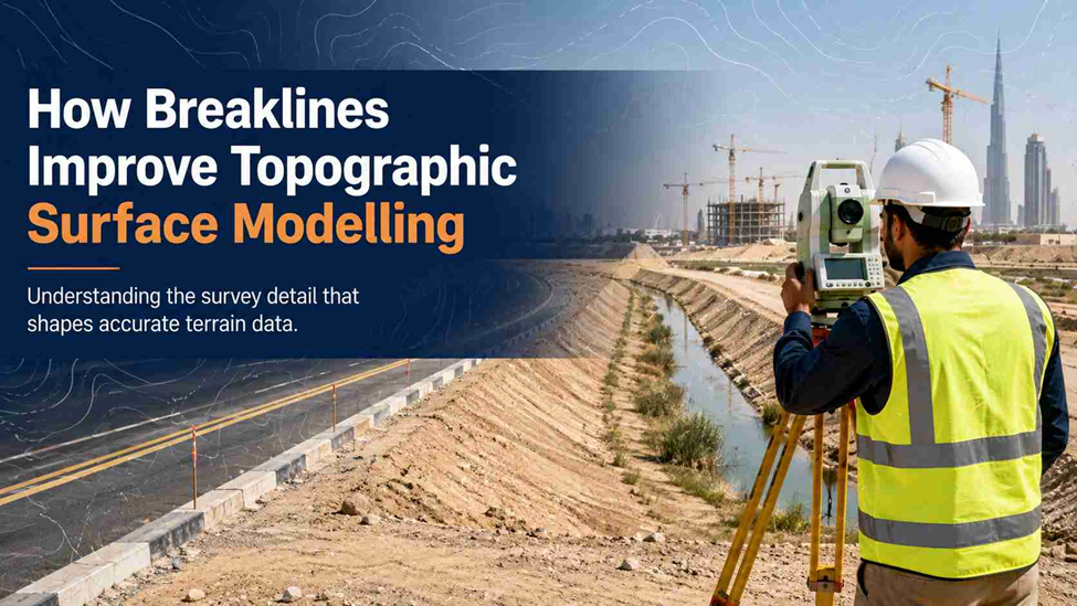
Have you ever seen a contour map that looks perfect on paper, but doesn’t match how the site actually drains? This happens more often than people think. Usually, the reason is simple: something is missing from the survey data a breakline.
Breaklines don’t get much attention outside survey teams. But they decide whether a topographic surface is accurate or misleading. Here’s a simple breakdown of what they are, why they matter, and where they show up in real survey work across the UAE.
What Is a Breakline in Survey Data?
A breakline is a line surveyed along a spot where the ground changes suddenly not gradually. Common examples:
- The top or bottom edge of a berm
- A kerb line along a road
- The edge of a canal, ditch, or retaining wall
- A ridge line or the base of a slope
Normal survey points only record height at one spot. A breakline records the shape of a change between two points. It tells the software: don’t smooth the ground here this edge is real, not an error.
Why Random Survey Points Aren’t Enough
Scattered points work fine on flat, open land. Problems start where the ground has an edge, a step, or a sudden slope change.
- Points alone can’t tell software “stop here, the ground drops”
- More points on flat ground still won’t fix a poorly defined kerb or canal edge
- Important lines — roads, drains, plot boundaries — need to be captured as lines, not guessed from nearby points
This is why field teams are trained to walk and record features, not just take grid points. Our topographic surveys always combine spot levels with feature-line capture for this reason.
How Breaklines Shape the TIN Surface
Most topographic software builds something called a TIN (Triangulated Irregular Network). It’s a mesh of triangles connecting survey points to form the ground surface.
Without guidance, the software draws triangles wherever the math is easiest not where the real ground actually changes. Breaklines fix this by:
- Making triangle edges follow the breakline, not cut across it
- Stopping a triangle from spanning both sides of a kerb, wall, or slope
- Keeping flat areas — like a road or a plot platform — modelled as flat, not tilted
In simple terms, breaklines stop the TIN from rounding off edges that should stay sharp.
How Breaklines Affect Contours
Contours are usually the first thing a client checks on a drawing. Breaklines are what keep them accurate.
- Contours should bend sharply at a kerb or wall — breaklines make this happen
- Without them, contours often curve smoothly across a feature that should have a hard edge — this looks like a mistake to anyone reviewing the drawing
- Along a canal or wall, breaklines stop contours from crossing into the water or excavation side
- Drainage direction on the map becomes far more reliable once breaklines are added
For sites with berms, canals, or graded platforms, this one detail often decides whether a contour map gets approved or comes back with revision comments.
What Happens If a Breakline Is Missing?
A missing breakline doesn’t always look wrong at first glance. That’s what makes it risky.
- Cut-and-fill volume numbers can be quietly wrong, because the model averages across an edge it shouldn’t
- A drainage design based on the surface may show water flowing the wrong way
- Retaining walls or slopes can look rounded instead of vertical, misleading anyone reading levels off the model
- Architects, MEP consultants, and civil engineers working from the surface inherit this error without knowing it’s there
This is why volume and earthwork numbers should always be checked against how the source data was captured not just the final drawing. Our volume calculation work depends heavily on accurate breaklines for this reason.
Breaklines in Road, Drainage and Infrastructure Surveys
Infrastructure projects need breaklines the most, because the design depends on precise edges.
- Roads — kerb lines, edge of carriageway, and crown lines all need to be captured as breaklines so the road models correctly for design
- Drainage — invert levels along a channel or ditch need connected breaklines, or the flow model won’t be reliable
- Canals and utility corridors — top-of-bank and toe-of-slope lines keep excavation and stability numbers accurate
- Gate levels and plot platforms — flat zones need to stay flat in the model, which connects directly to gate level computation checks before Dubai Municipality approval
On UAE road and infrastructure projects, this level of detail isn’t optional. It’s part of what gets a survey through municipal review without rework.
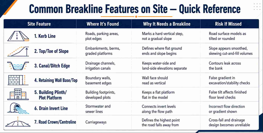
Quick Reference: Common Breakline Features on Site
A simple checklist to review before surface modelling starts.
From Field Breaklines to the Final Drawing
A clean topographic drawing is the result of a simple chain:
- The field team identifies which features need line capture, not just spot points
- Breaklines are surveyed along kerbs, edges, slopes, and drains while walking the site
- Office processing builds the TIN using both points and breaklines together
- Contours, cross-sections, and volume outputs come from this corrected surface
- The drawing is checked against the raw field data before it’s sent for design or approval
Skip step 2 on site, and no amount of office work later can fully fix it. This is the part clients rarely see but it’s usually what separates a topographic survey that holds up under scrutiny from one that raises questions later.
Plan with Precision. Build with Confidence.
From topographic surveys and GPS surveying to 3D laser scanning and setting out, NES delivers accurate surveying solutions for your project.