
Gate Level Computation in Dubai: Approvals, Accuracy and Common Survey Errors
Introduction
Gate level computation is an important step in building planning in Dubai. It determines the correct elevation of a property entrance in relation to the adjoining road and plot levels. Accurate measurements help ensure proper vehicle access, drainage and entrance design while reducing errors during construction.
Incorrect gate levels can lead to drawing revisions, approval delays and changes to site work. This guide explains the importance of gate level computation, factors affecting accuracy, common survey errors and how a land surveyor supports the building approval process.
1. What Is Gate Level Computation?
Gate level computation determines the correct elevation of a property’s entrance in relation to road and plot levels. The surveyor measures important site features, including road edges, kerbs, plot boundaries, benchmarks and proposed entrance levels.
This information helps architects and engineers plan vehicle access, drainage and entrance slopes. The required gate level depends on site conditions, project design and applicable authority requirements.
2. Factors That Affect Gate Level Accuracy
Accurate gate level computation depends on reliable site measurements and the correct survey reference. Several factors can affect the final results.
Road Elevation
Road levels may vary along the plot frontage, particularly on sloping roads or near junctions. Surveying the relevant points helps the design team understand the actual elevation differences before deciding on the entrance level.
Survey Benchmark
A benchmark provides a reference for measuring elevations. If the wrong reference is used or its relationship to the project datum is unclear, the resulting levels may not match the information used in other drawings.
Existing Plot Conditions
Ground elevations, boundary conditions and neighbouring properties can affect the connection between the road and the entrance. These features should be considered when reviewing the proposed gate level.
Survey Equipment and Measurement Methods
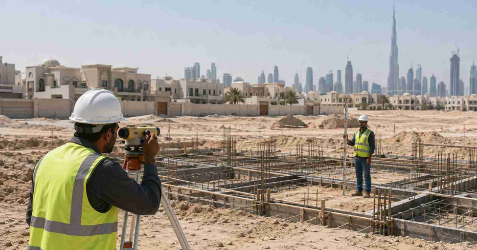
Surveyors may use digital levels, total stations or suitable GNSS equipment depending on the site and required accuracy. The equipment must be appropriate for the work, and measurements should be checked against the relevant survey reference.
Drainage and Entrance Slopes
The gate level should be coordinated with external grading, drainage and vehicle access. An unsuitable level difference can create steep entrance slopes or cause water to collect near the property.
Updated Site Information
Roadworks, resurfacing and nearby construction can change existing conditions. Using recent survey measurements helps the design team work with reliable information rather than outdated levels.
Considering these factors early helps reduce discrepancies between survey reports, architectural drawings and actual site conditions.
3. Where Gate Level Data Fits Into the Dubai Approval Process
Gate level information can support the design and approval process for building projects in Dubai. The exact procedure depends on the plot location, project type and relevant approving authority.
Step 1: Review the Project Requirements
The project team identifies the plot details, proposed entrance location, road access conditions and applicable authority requirements.
Step 2: Conduct the Site Survey
The surveyor measures the relevant road, kerb, plot and entrance levels. The measurements are related to an appropriate survey benchmark or reference datum.
Step 3: Prepare the Gate Level Information
The survey data is processed and presented in a report or drawing showing the relevant elevations and proposed entrance level.
Step 4: Coordinate With the Design Consultant
The architect and engineer use the information to coordinate the entrance layout, ground floor level, external paving, access slope and drainage design.
Step 5: Obtain the Required Confirmation or Approval
Depending on the project, gate level confirmation or approval may involve the Roads and Transport Authority (RTA), Dubai Municipality, Dubai Development Authority (DDA) or another relevant entity.
The project team should confirm the applicable submission requirements before proceeding. A survey report supports the approval process but does not replace any formal approval required by the relevant authority.
Step 6: Verify the Levels Before Construction
Before site work begins, the consultant and contractor should check that the construction drawings reflect the applicable approved levels. Any significant difference between the surveyed conditions and design should be reported and resolved before permanent work proceeds.
4. Common Gate Level Errors That Delay Building Permits
Gate level errors can create additional work during design review and construction. Most can be reduced through careful surveying and coordination.
Using Outdated Road Levels
Road levels may change following resurfacing, road improvement or infrastructure work. Old measurements may not represent the current site conditions.
Measuring Too Few Points
A single road level may not represent the entire plot frontage. Where the road slopes, the survey should capture enough relevant points to establish the elevation changes.
Using an Incorrect Benchmark
An unsuitable or unclear benchmark can create differences between the survey report and the levels shown in other project documents.
Ignoring Surrounding Plot Levels
Neighbouring ground levels and existing access arrangements can influence the entrance design. Ignoring these conditions may lead to difficulties when connecting the entrance with the surrounding area.
Overlooking Drainage and Access Slopes
The gate level should be considered alongside external grading and drainage. Poor coordination can lead to water accumulation, unsuitable entrance slopes or vehicle access problems.
Submitting Inconsistent Drawings
If the proposed gate level differs between the survey report, architectural drawings and engineering documents, the project team may need to clarify or revise the submission.
Changing Levels During Construction
Adjusting ground levels on site without checking the approved design can create discrepancies. Any change affecting the entrance elevation should be reviewed with the consultant and relevant authority where required.
Before submitting the documents, check that the plot details, benchmark, surveyed levels, proposed gate level and drawing revisions are consistent.
5. How a Land Surveyor Coordinates Gate Level Data With Architects and Engineers
Gate level computation requires coordination between the surveyor and the wider project team. Accurate measurements are most useful when they are available before the entrance design is finalised.
Coordination With Architects
The surveyor provides the measured levels needed to plan the entrance in relation to the road and proposed ground floor level. This helps the architect coordinate ramps, steps, external paving and entrance geometry.
Coordination With Civil Engineers
Civil engineers use the survey data to review external grading, drainage slopes and connections with surrounding infrastructure. Any level differences that could affect the design can be identified before construction.
Coordination With Infrastructure Consultants
Where road levels, access arrangements or infrastructure requirements affect the plot, the survey information helps the project team coordinate with the relevant consultants and authorities.
Coordination With Contractors
Contractors use the applicable approved drawings and established survey references to carry out site work. If actual ground levels differ from the design, the discrepancy should be reported before the work continues.
Preparing Clear Survey Deliverables
Depending on the project requirements, the surveyor may provide:
- Gate level computation report
- Surveyed road and plot levels
- Benchmark and reduced level information
- Proposed entrance level
- Relevant level differences and slopes
- Annotated survey drawings
- CAD files and PDF documentation, where required
Clear documentation helps architects, engineers and contractors interpret the survey information consistently.
6. What Equipment Is Used for Gate Level Computation?
The equipment used for gate level computation depends on the site conditions, measurement requirements and required accuracy.
Digital Level
A digital level measures elevation differences between survey points using a suitable staff. It is useful for transferring and checking levels across a site.
Total Station
A total station measures horizontal angles, vertical angles and distances to establish the positions and elevations of site features. Surveyors can use it to measure road edges, plot features and entrance points.
GNSS/GPS Survey Equipment
Survey-grade GNSS equipment can establish coordinates and support elevation measurements when satellite conditions, correction methods and reference systems are suitable.
The surveyor selects the appropriate equipment and measurement method for the project. Correct referencing, field checks and clear documentation are just as important as the instrument itself.
7. When Should You Arrange a Gate Level Survey?
Gate level computation should be arranged early enough for the results to be used during design and approval preparation.
Common situations include:
- Before preparing building permit submissions
- Before finalising the entrance and ground floor design
- When planning a new villa or commercial development
- When road or plot levels have changed
- When modifying an existing entrance
- When the consultant needs verified levels for design coordination
- When site conditions differ from the available drawings
Arranging the survey early gives the project team time to identify discrepancies and resolve them before they affect construction.
8. What Information Should You Prepare Before Booking a Gate Level Survey?
Providing the available project details helps the surveyor understand the site and plan the required work.
Prepare the following information where available:
- Plot number and site location
- Plot plan or affection plan
- Existing architectural or site drawings
- Available road and infrastructure information
- Proposed entrance location
- Project consultant’s requirements
- Previous gate level documents or authority comments
- Required submission format and deadline
The surveyor can review these details and advise whether additional information or site measurements are needed.
Conclusion
Gate level computation plays an important role in coordinating a building entrance with road elevations, plot conditions and project requirements. Accurate survey information helps reduce discrepancies in drawings, drainage issues and changes during construction.
Using a suitable benchmark, measuring the relevant site levels and coordinating with architects and engineers helps the project team establish a consistent entrance design. The survey and submission process should always follow the requirements applicable to the specific plot and project.
Need Gate Level Computation in Dubai?
Northern Engineering Surveys L.L.C. provides surveying services for construction and engineering projects. Contact the team to discuss your gate level computation requirements and the survey information needed for your project.
Website: https://nesdubai.com/
Email: info@nesdubai.com
Phone: +971 50 255 8005
Frequently Asked Questions
1. What is gate level computation in Dubai?
Gate level computation determines the elevation of a property’s entrance in relation to the road, plot and other relevant site levels. It supports entrance design and the applicable approval process.
2. Is gate level approval required for a building permit in Dubai?
The requirement depends on the project, plot location and approving authority. The project consultant should confirm whether gate level confirmation or approval is needed and identify the relevant authority.
3. What information is needed for gate level computation?
The surveyor may need the plot details, road levels, benchmark information, entrance location and available project drawings. Additional information may be required depending on the site and submission requirements.
4. Which equipment is used for gate level surveys?
Surveyors may use digital levels, total stations or survey-grade GNSS equipment, depending on site conditions, the reference system and the required accuracy.
5. Can incorrect gate levels delay a building project?
Yes. Incorrect or inconsistent levels can lead to drawing revisions, approval coordination, entrance design changes, drainage problems and rework during construction.
6. When should gate level computation be completed?
It is generally best to arrange the survey early enough for the architect and engineer to use the verified levels during design and approval preparation. Any required authority confirmation should be planned before the relevant construction work begins.