
3D Laser Scanning: A Practical Guide for Contractors & Architects
Introduction
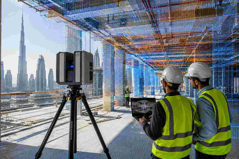
onstruction drawings may not always match actual site conditions, creating challenges for contractors and architects. 3D laser scanning captures existing structures as detailed point cloud data, helping teams verify dimensions, prepare accurate drawings, coordinate designs and reduce construction rework. It is particularly useful for refurbishment, MEP coordination and as-built documentation. The captured data also supports BIM modelling and helps identify potential clashes before installation begins. This allows project teams to plan work with a clearer understanding of the existing structure.
What Is 3D Laser Scanning?
3D laser scanning is a surveying method that captures the dimensions and geometry of buildings and structures using laser measurements. It creates a digital 3D point cloud that helps contractors and architects check dimensions, prepare as-built drawings, plan installations and develop accurate BIM models based on existing site conditions.
1. Using 3D Laser Scanning to Identify Design Conflicts Before Construction
Design conflicts are not always obvious on a two-dimensional drawing. A duct may appear to fit within a ceiling plan but clash with a beam when installed. A new partition may interfere with existing pipework, or equipment may require more clearance than the available space allows.
A 3D laser scanning survey captures the visible geometry of the surrounding environment. When the point cloud is compared with proposed design information, the project team can investigate these conflicts before installation begins.
For example, a mechanical contractor planning new ductwork can use scanned ceiling geometry to understand the positions of beams, columns and other visible obstructions. The design team can then review the proposed route and adjust it where necessary.
This workflow is particularly useful for:
- Mechanical, electrical and plumbing (MEP) coordination.
- Ceiling and service installation.
- Equipment replacement in existing facilities.
- Structural modifications.
- Interior fit-out and refurbishment.
Laser scanning does not automatically identify every design conflict. The results depend on the visibility of existing elements, the quality of the design model and the coordination process used by the project team.
2. Measuring Irregular Structures Without Hundreds of Manual Measurements
Some structures are difficult to document using conventional measurements alone. Curved walls, sloping roofs, complex staircases, industrial equipment and irregular concrete surfaces may require numerous individual observations.
3D laser scanning captures dense surface data from multiple positions. This allows surveyors and design teams to examine the geometry after the site visit rather than relying entirely on measurements selected in advance.
The resulting point cloud can support the preparation of sections, elevations and detailed drawings. Where appropriate, it can also be used to measure clearances, investigate surface alignment and document unusual structural features.
For architects, this is useful when working with existing buildings that have non-standard geometry. Contractors can use the same information to plan fabrication, installation and modifications around the measured structure.
The scanner records visible surfaces rather than hidden internal construction. Elements concealed behind finishes or other obstructions may require additional inspection methods.
3. How Laser Scanning Helps with Prefabrication and Off-Site Manufacturing
Prefabricated components are manufactured away from the installation location and assembled on site. Their dimensions must match the available space, particularly when working around existing columns, walls, slabs and service connections.
If fabrication is based on outdated drawings, even a small dimensional difference can lead to adjustment work, cutting or remanufacturing.
A point cloud survey provides measured information about the installation area. Design and fabrication teams can use the data to check dimensions, review clearances and assess whether proposed components fit the existing structure.
Applications include:
- Prefabricated pipework and service assemblies.
- Steelwork modifications.
- Building façade components.
- Plant room equipment.
- Modular interior systems.
- Replacement components for existing industrial facilities.
The survey must capture the relevant interfaces and reference points. Where tight fabrication tolerances apply, critical dimensions should be verified using an appropriate measurement method before manufacturing is approved.
4. Documenting Buildings Before Demolition or Refurbishment
Refurbishment projects frequently involve buildings with incomplete records. Original plans may not show later alterations, abandoned services or changes made during previous construction phases.
Before demolition or renovation, a 3D building scanning survey can document visible site conditions. This gives the project team a reference for the existing layout and helps identify areas that need further investigation.
Architects can use the data to prepare existing-condition drawings, assess spatial constraints and develop proposed layouts. Contractors can use it to plan access, removal sequences and new installations around retained structures.
For example, when converting an existing commercial building into a different type of space, the project team may need accurate floor geometry, column positions, ceiling heights and façade dimensions. A registered point cloud can provide a shared reference for these design decisions.
Scanning does not replace structural inspections, hazardous-material assessments or investigations into concealed utilities. Those requirements must be addressed separately where applicable.
5. Comparing Installed Work with Design Drawings
Construction teams need to establish whether completed work matches the intended design. Traditional inspection methods remain important, but checking a large or geometrically complex area may require many separate measurements.
As-built laser scanning captures the visible condition of completed elements. The resulting dataset can be compared with the approved design model or drawings to investigate dimensional differences.
Depending on the project requirements, this process can help verify:
- Column and beam positions.
- Slab edges and floor geometry.
- Wall alignment and openings.
- Equipment installation clearances.
- Visible structural interfaces.
- Selected completed construction elements.
A deviation report can help the project team identify areas that need closer inspection. However, the survey must use suitable coordinate control and agreed tolerances for the comparison to be meaningful.
Not every deviation visible in a point cloud represents a construction defect. Measurement uncertainty, registration quality, design assumptions and the specified acceptance criteria must all be considered before a decision is made.
6. Turning Survey Data into Drawings and BIM Models
Collecting scan data is only one part of the workflow. The information must be processed into a format that architects, engineers and contractors can use.
A registered point cloud can serve as the basis for several types of project deliverables.
CAD Drawings
Survey teams can extract relevant geometry to prepare floor plans, elevations, sections and details. DWG and DXF files allow design teams to work with measured information in compatible CAD applications.
Existing-Condition BIM Models
In a Scan to BIM workflow, the point cloud is used as a reference for modelling building elements in software such as Autodesk Revit. The model may include walls, floors, columns, doors and other agreed components.
The modelling scope should specify the required Level of Development (LOD), element coverage and dimensional tolerances.
Dimensional Reports
Where verification is required, the survey data can be used to prepare measurements or comparisons against specified design dimensions. These outputs help project teams investigate discrepancies and determine whether corrective work is needed.
Point Cloud Files
The registered dataset can be supplied in a suitable point cloud format for viewing, measurement and further processing. File formats and software compatibility should be confirmed before the survey begins.
The best deliverable is the one that supports the next project task. A contractor who needs clearance measurements may not require a full BIM model, while an architect planning a major refurbishment may benefit from both point cloud data and modelled building elements.
7. What Can Affect the Quality of Scanned Data?
A detailed point cloud is useful only when the captured data is suitable for the intended work. Several practical factors affect the quality of a 3D laser scanning survey.
Restricted Visibility
The scanner records surfaces that are visible from its scan positions. Equipment, furniture, temporary structures and other obstructions can prevent the capture of important areas. Additional scan positions may be needed to improve coverage.
Surface Conditions
Reflective, dark, transparent or highly angled surfaces can affect measurement performance. The survey method should account for the materials and conditions present at the site.
Scan Registration
Individual scans must be aligned into a consistent dataset. Poor overlap or unsuitable registration can create discrepancies between different scan positions.
Coordinate Control
Projects that require integration with engineering drawings need a suitable coordinate reference. The survey team should confirm the project grid, datum and control requirements before collecting data.
Processing Requirements
Large datasets may require cleaning, registration, segmentation and conversion before they can be used in CAD or BIM software. The amount of processing depends on the deliverables and the complexity of the site.
These factors should be discussed during survey planning rather than after the data has been collected.
8. Planning a Laser Scanning Survey Around Site Operations
On an active construction site, the survey must fit around ongoing work, access restrictions and safety requirements. Poor planning can leave important areas inaccessible or require a return visit.
Before arranging a survey, contractors and architects should identify the areas to be captured and the decisions the data needs to support.
A practical planning checklist includes:
- Confirm the areas, floors and structures that need to be surveyed.
- Identify restricted-access rooms and operational equipment.
- Determine whether the survey needs to be tied to the project coordinate system.
- Specify the required point cloud, CAD drawings or BIM deliverables.
- Agree on accuracy requirements and acceptance criteria.
- Check the required file formats with the design and construction teams.
- Arrange access to areas that may be blocked during normal site operations.
It is also important to distinguish between site capture time and total delivery time. Registration, drawing preparation, BIM modelling and quality checks can continue after fieldwork is complete.
9. How to Select the Right 3D Laser Scanning Service
The suitability of a 3D laser scanning company depends on its ability to deliver usable, verified information for the intended application.
Before appointing a survey provider, consider the following points.
Survey methodology: Ask how the team plans to capture the site, manage obstructions and combine individual scans.
Relevant experience: Look for experience with the type of building, structure or construction activity involved in your project.
Accuracy requirements: Explain which dimensions are critical and how the results will be checked against the project requirements.
Deliverable specifications: Confirm whether the scope includes a registered point cloud, CAD drawings, as-built documentation, dimensional reports or a BIM model.
Software compatibility: Ensure the output can be used by the architect, consultant, contractor or BIM coordinator without unnecessary conversion work.
Quality assurance: Ask how registration, coverage and critical measurements will be checked before the data is delivered.
A clearly defined scope helps prevent disagreements over whether modelling, additional site visits or detailed verification are included in the quoted service.
Conclusion
3D laser scanning is useful when project teams need a detailed record of existing site conditions before making design or construction decisions. It can support prefabrication, refurbishment, installation planning, as-built verification and BIM coordination.
For contractors, the data helps establish what is available on site before components are manufactured or installed. For architects, it provides a measured reference for developing designs around existing structures.
The value of a laser scanning survey depends on the quality of the fieldwork, the coordinate reference, the processing method and the suitability of the final deliverables. Defining these requirements at the beginning helps ensure that the collected information supports the work it was intended for.
Need 3D Laser Scanning Support for Your Project?
Northern Engineering Surveys L.L.C provides surveying solutions to support construction planning, existing-building documentation and as-built verification.
Whether you need point cloud data, measured building drawings or scanning information for design coordination, discuss your project requirements with the team to establish the appropriate survey scope and deliverables.
Website: https://nesdubai.com/
Frequently Asked Questions
1. What is the main purpose of 3D laser scanning?
The main purpose is to capture the visible geometry of a site, building or structure in three dimensions. The resulting point cloud can support measured drawings, design coordination, dimensional verification and BIM modelling.
2. Can laser scanning help reduce rework on construction projects?
It can help identify discrepancies between existing conditions and proposed designs before installation. This gives the project team an opportunity to investigate potential conflicts and resolve them earlier, although it cannot eliminate every source of rework.
3. Is 3D laser scanning suitable for refurbishment projects?
Yes. It is useful when existing drawings are incomplete, building layouts have changed or new installations must fit around retained structures. The captured data can support existing-condition drawings and Scan to BIM workflows.
4. What is the difference between laser scanning and Scan to BIM?
Laser scanning is the process of measuring physical surfaces and collecting point cloud data. Scan to BIM uses that data as a reference to create a structured building information model.
5. Can 3D laser scanning verify construction tolerances?
It can support dimensional comparisons against design requirements. The suitability of the results depends on the measurement method, survey control, registration quality and required tolerance. Critical acceptance checks may require additional measurements.
6. Does a laser scanner capture objects behind walls?
No. Conventional terrestrial laser scanning captures visible surfaces and cannot directly measure concealed elements behind solid walls. Additional investigation techniques are needed for hidden services or internal structural conditions.
7. Which files should I request from a laser scanning company?
Depending on the project, you may need a registered point cloud, DWG or DXF drawings, PDF plans, sections, elevations, dimensional reports or a Revit-compatible BIM model. Specify the intended use before the survey starts.
8. When should a contractor arrange a 3D laser scanning survey?
A contractor should consider scanning before refurbishment, prefabrication, MEP installation, structural modification or as-built verification when existing geometry affects the work. The survey should be scheduled while the relevant areas remain accessible.