
Digital Terrain Model (DTM): Types, Applications and Uses in Construction
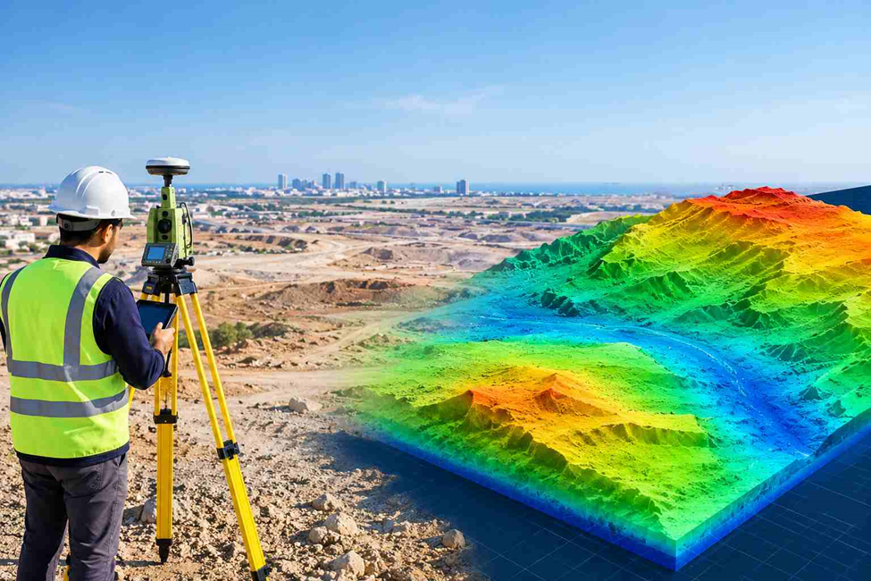
A construction site may look level from the ground, but small changes in elevation can affect drainage, road gradients, excavation quantities and the finished platform level. Engineers need more than a visual impression of the land before deciding how a site should be developed.
A Digital Terrain Model (DTM) provides a digital view of the underlying ground surface. Built from survey measurements and elevation data, it helps engineers understand how the land rises, falls and changes across a project area.
For surveyors, consultants and contractors, the value of a DTM goes beyond a three-dimensional view. It provides terrain information that can be used to assess existing ground conditions, prepare design surfaces and plan earthworks with a clearer understanding of the site.
What Is a Digital Terrain Model (DTM)?
A Digital Terrain Model (DTM) is a digital model that represents the natural ground surface using elevation data. It shows variations in the terrain, including hills, slopes, ridges and depressions, while excluding above-ground features such as buildings and trees. DTMs are created from surveying measurements, LiDAR data or drone mapping and are used to understand ground conditions. In construction and engineering, they help with site grading, road design, drainage planning and earthwork calculations.
How Is a Digital Terrain Model Created?
Creating a reliable DTM involves more than collecting elevation points and connecting them in software. The quality of the final model depends on the survey method, the coverage of the ground and the way the collected data is processed.
1. Surveying the Site
The process begins with collecting information about the existing ground. Surveyors may use GNSS equipment, total stations, drone-based photogrammetry or LiDAR, depending on the site size, terrain, visibility and required accuracy.
For construction projects, the survey may need additional measurements along road edges, kerbs, drainage channels, embankments and other locations where the ground changes direction or slope.
2. Processing the Elevation Data
The collected measurements are checked and processed to establish their coordinates and elevations. In datasets captured using LiDAR or photogrammetry, above-ground points may need to be separated from ground points.
This classification step is important. If building roofs, tree canopies or other unwanted surface points remain in the terrain dataset, the resulting model may not represent the true ground correctly.
3. Building the Terrain Surface
The processed ground points are used to create a digital surface. Depending on the project, the surface may be generated using a TIN or a raster grid.
Surveyors and mapping specialists also incorporate breaklines where necessary. These lines define important changes in the ground, such as the top and bottom of a slope, the edge of a channel or a road kerb. Without suitable breaklines, a model may smooth over features that matter to engineering design.
4. Checking the Model
Before the DTM is delivered, the surface should be checked for gaps, unusual elevation changes, incorrect triangles, missing ground information and inconsistencies with the original survey.
The team should also verify that the coordinate reference system, vertical datum, units and required accuracy are appropriate for the project. These checks help prevent errors from being carried into design and quantity calculations.
5. Preparing the Deliverables
The final output depends on the intended use. Deliverables may include a 3D terrain surface, elevation grid, contour drawing, spot levels, cross-sections or other engineering data. For construction teams, the most useful format is one that fits the design software and allows the terrain to be checked against the project requirements.
Types of Digital Terrain Models
DTMs can be represented in different ways. The choice depends on the terrain, the level of detail required, the size of the dataset and the analysis that needs to be performed.
1. Raster-Based DTM
A raster DTM represents the terrain as a grid of cells, with each cell storing an elevation value.
This format is useful for terrain analysis over large areas. Engineers and GIS specialists can use raster surfaces to examine slope, aspect, drainage patterns and changes in elevation.
The cell size matters. A smaller cell size can capture finer detail when the source data supports it, but it also creates a larger dataset. A fine grid does not automatically mean the model is accurate.
2. TIN-Based DTM
A Triangulated Irregular Network (TIN) represents the terrain using connected triangles formed from measured elevation points.
TIN surfaces can accommodate irregularly spaced survey points and incorporate breaklines along important terrain features. This makes them useful for detailed engineering work where changes in slope and ground geometry need to be represented.
A TIN is often suitable for site grading, road design and earthwork calculations when the input survey data has sufficient coverage and detail.
3. Contour-Based Terrain Representation
Contour lines connect locations with the same elevation. They provide a familiar way to read the shape of the land on a two-dimensional drawing.
Contours can be generated from a DTM and can also be used as input for constructing a terrain surface. However, contour lines alone do not always preserve the full detail of the original survey. Their usefulness depends on contour intervals, source measurements and how the surface is reconstructed. For design work, the underlying elevation data should be reviewed alongside the contours rather than relying on the drawing alone.
Main Applications of a Digital Terrain Model
A DTM is useful whenever project decisions depend on the actual shape and elevation of the ground. Its role differs from one project to another, but it often provides a common terrain reference for design, planning and site assessment.
1. Construction Site Planning and Grading
Before construction begins, engineers need to compare existing ground levels with the proposed platform or finished ground levels.
A DTM helps the design team understand where the site is high or low, identify areas that require grading and examine how the proposed layout fits the existing terrain.
For contractors, this information supports the planning of excavation, filling and site preparation before major earthworks begin.
2. Cut-and-Fill Volume Calculations
Earthwork quantities depend on the difference between the existing ground and the proposed design surface.
A DTM can represent the existing terrain, while a separate design surface represents the intended finished level. Comparing the two allows the project team to calculate estimated cut and fill volumes.
These estimates help with budgeting, equipment planning, material allocation and monitoring earthworks. The reliability of the result depends on survey coverage, surface quality, calculation boundaries and the timing of the measurements.
3. Road and Infrastructure Design
Roads, access routes, pipelines and other linear infrastructure often cross land with changing elevations.
A terrain model helps engineers study ground profiles, examine cross-sections and assess how a proposed alignment interacts with existing terrain. It can also support the identification of steep sections and areas where significant earthworks may be required.
For long corridors, the model needs to cover the full design area and capture important terrain changes along the route.
4. Drainage and Surface Water Assessment
Water movement is strongly influenced by ground elevation and slope. A DTM can help engineers identify low-lying areas, surface depressions and potential flow paths.
This information supports preliminary drainage planning and terrain-based hydrological analysis. It can help identify locations that require closer investigation before drainage levels and gradients are finalised.
A DTM alone does not establish flood risk. Reliable flood assessment may also require rainfall data, runoff assumptions, drainage network information, soil characteristics and hydraulic modelling.
5. Slope and Terrain Analysis
DTMs can be used to calculate slope and examine how quickly the ground rises or falls across a site.
This is useful for road embankments, cut slopes, land development and preliminary terrain stability assessments. Engineers can identify areas with sharper elevation changes and decide where more detailed investigation may be necessary.
A terrain model can support a stability assessment, but it cannot replace geotechnical investigation where soil strength, groundwater or subsurface conditions are important.
6. Land Development and Site Selection
When comparing potential development areas, project teams need to understand the existing terrain before selecting building platforms, access routes and service corridors.
A DTM helps show how the ground varies across a site and where natural slopes may affect the proposed layout. Combined with boundary information, utilities and other site constraints, it supports a more informed planning process.
7. Environmental and Agricultural Analysis
Terrain information can help assess erosion patterns, land drainage, catchment characteristics and changes in the landscape.
In agriculture, elevation and slope data can support field drainage planning and land management. In environmental projects, a DTM may be used to analyse terrain conditions and assist with watershed or erosion studies.
The model’s suitability depends on the required resolution, the quality of the elevation data and the specific analysis being undertaken.
DTM vs DSM vs DEM: What Is the Difference?
DTM, DSM and DEM are closely related terms, but they should not automatically be treated as interchangeable. Their precise definitions can vary between software providers, mapping standards and industries.
| Feature | DTM | DSM | DEM |
| Main purpose | Represents bare-earth terrain | Represents the upper surface, including objects | General term for digital elevation data; meaning depends on the specification |
| Buildings and trees | Normally excluded | Normally included | Depends on the dataset’s definition |
| Typical information | Ground levels, slopes and depressions | Roofs, canopy tops and other visible surfaces | Elevation values represented digitally |
| Common uses | Grading, road design and ground-based earthworks | Building-height analysis, vegetation mapping and visibility studies | Terrain analysis, GIS and elevation-based applications |
| Key consideration | Ground points must be identified correctly | Surface features need sufficient capture detail | The dataset definition must be confirmed |
When Should You Use a DTM?
Use a DTM when the main requirement is to understand the ground itself, such as planning a site platform, calculating earthworks or studying terrain slopes.
When Should You Use a DSM?
Use a DSM when above-ground features matter, such as examining building heights, vegetation canopies or the visible surface of a developed area.
Is a DEM the Same as a DTM?
Not necessarily. DEM is often used as a broad term for digital elevation data, while some organisations use it more specifically for a particular type of elevation surface. Always check the dataset documentation to confirm whether buildings and vegetation have been removed.
Technologies Used to Generate a DTM
The best data collection method depends on the area to be mapped, site access, vegetation, required accuracy and available budget.
GNSS Surveying
GNSS equipment can collect ground coordinates and elevations across suitable open areas. It is useful for establishing survey control and measuring terrain points where satellite reception is adequate.
Total Station Surveying
A total station measures angles and distances to determine the positions and elevations of surveyed points. It is useful for capturing detailed site features, breaklines and locations that require controlled measurements.
Drone Photogrammetry
Photogrammetry uses overlapping aerial images to reconstruct three-dimensional information. After processing and suitable ground classification, the resulting data can support DTM generation.
Its ability to represent the actual ground depends on visibility. Dense vegetation or structures can prevent aerial images from capturing the ground beneath them.
LiDAR Surveying
LiDAR measures distances using laser pulses and can collect dense three-dimensional point-cloud data. Depending on the system and survey conditions, some laser returns may reach the ground through gaps in vegetation, allowing ground points to be classified for terrain modelling.
LiDAR can be useful for extensive areas and complex terrain, but the quality of the final DTM still depends on point density, classification and verification.
No single method is best for every site. A survey specification should define the required accuracy, coverage, deliverables and ground conditions before the collection method is selected.
What Affects DTM Accuracy?
A detailed-looking model is not necessarily a reliable one. Several factors determine whether a DTM is suitable for engineering decisions.
- Survey point coverage: Sparse measurements may fail to capture narrow channels, abrupt slopes and small changes in ground level.
- Ground classification: Incorrectly retaining vegetation or building points can distort the model.
- Breakline collection: Missing kerbs, slope edges and drainage features may cause the model to represent the terrain incorrectly.
- Survey control: Coordinate and elevation errors can affect the entire surface.
- Terrain complexity: Irregular ground generally requires more careful data collection than a broad, uniform area.
- Processing and validation: Poor interpolation, gaps or incorrect surface settings can introduce errors.
- Data age: Excavation, filling and ongoing construction can make an older DTM unsuitable for current site conditions.
For construction projects, the required accuracy should be defined by the design purpose and project specification. The survey team should also verify the surface against suitable independent checks rather than relying only on how smooth the model appears.
What Information Can a DTM Deliver?
Depending on the project scope, a terrain-modelling workflow may provide:
- A digital terrain surface in raster or TIN format
- Contour lines and spot elevations
- Terrain profiles and cross-sections
- Slope and elevation analysis
- Existing-ground data for cut-and-fill calculations
- CAD-compatible drawings or surfaces for engineering design
- GIS-ready elevation data for spatial analysis
The exact deliverables should be agreed before the survey starts. This helps ensure the data is compatible with the consultant’s design software and can be used by the contractor without unnecessary conversion or rework.
Conclusion
A Digital Terrain Model (DTM) helps engineers understand ground elevations and terrain changes for site grading, road design, drainage planning and earthwork calculations. Its accuracy depends on the survey method, source data and processing quality. For construction projects across Dubai and the UAE, reliable terrain data supports better planning and informed engineering decisions.
Need Terrain Survey Data for Your Project?
Northern Engineering Surveys L.L.C. provides surveying and mapping services for construction, engineering and infrastructure projects. If your project requires topographic information, terrain mapping or elevation data for design and site planning, discuss the survey scope and required deliverables with the NES team.
Website: https://nesdubai.com/
Email: info@nesdubai.com
Phone: +971 50 255 8005
Frequently Asked Questions
1. What is a Digital Terrain Model used for?
A DTM is used to represent ground elevations and terrain shape. Common applications include site grading, road design, earthwork calculations, drainage assessment and slope analysis.
2. How is a DTM different from a topographic survey?
A topographic survey is the process of collecting information about a site’s elevations and physical features. A DTM is one possible output created from the survey’s ground elevation data. A topographic survey may also include buildings, utilities, boundaries and other features that are not part of a bare-earth terrain model.
3. Can a DTM be created using drone data?
Yes. Drone photogrammetry or LiDAR can provide data for DTM generation. The method’s suitability depends on ground visibility, vegetation, terrain conditions, classification quality and the project’s accuracy requirements.
4. What is the difference between a raster DTM and a TIN DTM?
A raster DTM stores elevation values in a regular grid, while a TIN represents the surface using connected triangles built from elevation points. Both can represent terrain, but their suitability depends on the dataset and the intended analysis.
5. Can a DTM be used for cut-and-fill calculations?
Yes. An existing-ground DTM can be compared with a proposed design surface to estimate excavation and fill quantities. The result depends on the survey quality, surface definitions, calculation boundary and date of the source data.
6. How accurate is a Digital Terrain Model?
DTM accuracy varies with the survey method, ground conditions, point density, control quality, processing and validation. The required accuracy should be specified according to the engineering task rather than assumed from the model’s resolution alone.
7. Does a DTM include buildings and trees?
A conventional bare-earth DTM excludes buildings and trees from the terrain surface. These features may be present in the original survey data but should be removed or classified separately during processing.
8. Which file formats can be used for a DTM?
Common options include raster elevation formats and TIN or other 3D surface formats. Contours, point data and CAD or GIS deliverables may also be provided. The suitable format depends on the receiving team’s software and project requirements.