
Corridor Mapping for Infrastructure Projects: Survey Data, Route Planning and Construction
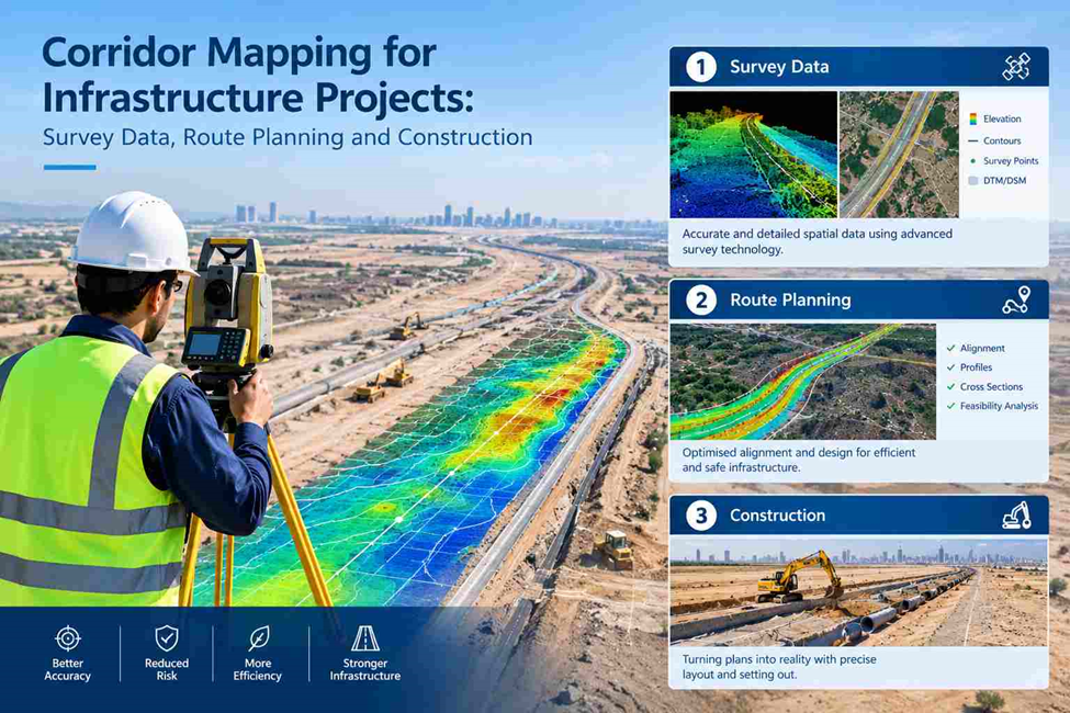
Infrastructure projects often pass through uneven terrain, existing roads, drainage systems and utility networks. Before construction begins, engineers need accurate information about the route and surrounding site conditions.
Corridor mapping provides detailed survey data on terrain, ground elevations and existing physical features along a planned or existing route. This information helps engineers assess route alignment, plan infrastructure design, estimate earthwork quantities and coordinate construction activities for roads, pipelines, railways and utility networks.
What Is Corridor Mapping?
Corridor mapping is a surveying process that collects spatial data along a defined route or linear area. It captures roads, drainage channels, utilities, structures and ground elevation changes along the corridor.
The survey scope depends on project requirements, such as route alignment, terrain profiles, cross-sections and existing infrastructure. The collected data is processed into engineering drawings, maps and digital terrain models to support infrastructure design and construction planning.
Why Is Corridor Mapping Required Before Infrastructure Construction?
A route that appears suitable on a preliminary plan may present several challenges on the ground. Elevation changes can affect road gradients, drainage conditions may influence the design, and existing utilities can restrict where excavation or new infrastructure can be placed.
A corridor mapping survey helps identify these conditions before they become costly construction problems.
1. Route Alignment and Feasibility
Engineers need accurate information about the land before selecting or finalising a route. Corridor mapping records ground conditions, existing features and changes in elevation along the proposed alignment.
This information helps design teams compare route options, assess physical constraints and identify areas that may require additional investigation or design adjustments.
2. Terrain and Elevation Assessment
Ground levels influence road profiles, pipeline gradients, drainage design and earthwork quantities. Surveyors collect elevation data along the corridor to show how the terrain changes over distance.
A longitudinal profile illustrates elevation changes along the route, while cross-sections show the ground shape across selected points. Together, these outputs support grading decisions and civil engineering design.
3. Existing Infrastructure Identification
Roads, buildings, drainage structures, access points and visible utility features can affect a proposed route. Mapping these features gives engineers a clearer picture of the existing site conditions.
Where underground services are involved, a separate utility investigation using appropriate detection methods may be required. Surface corridor mapping alone does not confirm the exact position or depth of buried pipes and cables.
4. Earthwork and Quantity Planning
Cut-and-fill calculations depend on reliable ground levels and the proposed design surface. Corridor survey data can help engineers estimate excavation, embankment and other earthwork requirements when combined with the relevant design information.
These calculations support material planning, cost estimation and construction scheduling.
How Is a Corridor Mapping Survey Carried Out?
The survey method depends on the route length, site accessibility, required accuracy and final deliverables. A typical workflow includes the following stages.
Step 1: Review the Route and Survey Requirements
The survey team reviews the proposed alignment, available drawings, project coordinate system, required survey limits and intended use of the data.
This stage establishes which features need to be captured and where additional detail is necessary. It also helps determine suitable survey equipment and field procedures.
Step 2: Establish Survey Control
Reliable positioning is essential when measurements collected across a long route must fit together within a consistent coordinate framework.
Survey control points and suitable GNSS/GPS or total station methods are used according to site conditions and project specifications. Existing control data must be checked before it is adopted for the survey.
Step 3: Collect Field Data Along the Corridor
Surveyors record relevant ground levels, terrain changes, road edges, structures, drainage features, visible utilities and other specified site details.
Depending on the project, data collection may use GNSS RTK receivers, total stations, mobile mapping systems, UAV photogrammetry or a combination of methods. Difficult terrain, obstructed satellite reception and restricted access may require additional ground measurements.
Step 4: Process and Verify the Survey Data
Field observations are checked against the survey control and project requirements. The processing stage includes reviewing coordinate consistency, elevation values, missing areas and the quality of captured features.
Where different data sources are combined, their coordinate systems, coverage and accuracy must be checked before they are used together.
Step 5: Prepare Engineering Mapping Deliverables
The verified information is converted into the required survey outputs. Depending on the scope, these may include corridor plans, contour mapping, longitudinal profiles, cross-sections, digital terrain models and CAD files.
The final data gives designers and construction teams a common reference for reviewing site conditions and developing the next project stage.
Technologies Used for Corridor Mapping
No single survey instrument is suitable for every corridor. The selection depends on the terrain, required detail, route length and accuracy specified by the client.
GNSS RTK Survey: GNSS RTK equipment provides coordinate and elevation measurements where satellite reception and correction services support the required accuracy. It is useful for survey control and collecting ground points along accessible routes.
Total Station Survey: A total station measures angles and distances to determine precise positions. It is particularly useful around structures, in obstructed areas and where detailed measurements must be tied to established control.
Mobile Mapping: Mobile mapping systems collect spatial data and imagery while moving along accessible routes. Depending on the system and workflow, they can capture road features, roadside assets, structures and dense point-cloud information over extended areas.
UAV and Drone Mapping: Drone photogrammetry can capture aerial imagery for producing orthomosaics, surface models and terrain information where site conditions, permissions and project requirements allow. Vegetation can limit the accuracy of bare-earth terrain extraction, so ground survey data may still be needed.
3D Laser Scanning: Laser scanning records dense three-dimensional measurements of visible surfaces. It can be useful for complex structures, road infrastructure, bridge approaches and locations where detailed existing-condition documentation is required.
Combining technologies can improve coverage, but all datasets must be properly referenced and quality-checked before being used for engineering decisions.
What Does a Corridor Mapping Survey Deliver?
The required outputs should be agreed before fieldwork begins. Typical deliverables include:
- Corridor survey plans: A mapped view of the route, surrounding features and survey limits.
- Topographic survey data: Ground levels, contours, breaklines and relevant physical features.
- Longitudinal profiles: Elevation information along the route alignment.
- Cross-sections: Ground profiles across selected chainages or intervals.
- Digital terrain models (DTM): A representation of the ground surface developed from suitable terrain data.
- CAD drawings: DWG or DXF files for use in compatible engineering design workflows.
- Coordinate and point reports: Survey observations and coordinate information in the agreed project reference system.
- Earthwork calculations: Cut-and-fill estimates where the required existing and proposed surfaces are available.
- Point clouds and imagery: Additional reality-capture outputs where mobile mapping, laser scanning or aerial survey is included.
The exact deliverables depend on the agreed scope. Not every corridor project requires all of these outputs.
Where Is Corridor Mapping Used?
Corridor mapping is relevant to a range of civil engineering and infrastructure projects.
Road and Highway Projects: Road corridor surveys support alignment design, pavement planning, drainage assessment, road widening and improvement works. Cross-sections and profiles help engineers evaluate the existing ground against the proposed road design.
Pipeline Routes: Pipeline corridor mapping records terrain and relevant surface features along the proposed route. The data supports route planning and engineering assessment, while underground investigations and specialist studies may be needed for buried services, geotechnical conditions or other subsurface risks.
Utility Networks: Water supply lines, sewer networks, power connections and telecommunications routes often extend across different site conditions. Corridor mapping helps coordinate the route with visible infrastructure and available survey records.
Railway Infrastructure: Railway alignment work requires careful assessment of ground levels, gradients, structures and surrounding features. Survey data supports the design and review of the rail corridor.
Drainage and Canal Projects: Elevation information and terrain profiles help engineers assess drainage paths, channel geometry and proposed gradients.
Industrial and Site Access Routes: Access roads, service corridors and connections between facilities may require detailed mapping to coordinate grading, drainage, utilities and existing structures.
Corridor Mapping vs Topographic Survey: What Is the Difference?
Both methods collect information about land and physical features, but their coverage is usually different.
A topographic survey generally documents the terrain and features within a defined site or survey boundary. It may cover a construction plot, industrial facility or development area.
Corridor mapping focuses on an extended route or linear strip of land. Its outputs are often organised around alignment, chainage, longitudinal profiles and cross-sections.
The methods can overlap. A corridor mapping project may include detailed topographic surveying, while a large topographic survey may cover an area surrounding a proposed route. The distinction is mainly in the project coverage and the way the data supports the design.
Common Challenges in Corridor Mapping
Long-distance surveying introduces practical issues that need to be managed throughout the project.
Changing site conditions: Terrain, vegetation, traffic and access restrictions may vary considerably along one route. Survey methods may need to change between sections.
Coordinate consistency: Data collected over multiple days or with different instruments must use a consistent reference framework. Unchecked coordinate or elevation differences can affect the final alignment.
Incomplete feature capture: Missing breaklines, drainage features or relevant structures can reduce the usefulness of the terrain model. Field checks and clear capture requirements help address these gaps.
Obstructed GNSS reception: Buildings, trees and other obstructions can affect satellite-based measurements. Total stations or alternative methods may be required in these locations.
Combining different datasets: Drone imagery, mobile mapping, ground observations and existing drawings may differ in resolution, coverage and accuracy. Their limitations must be understood before combining them.
Planning the survey around these challenges helps produce information that is more reliable for engineering design and construction use.
Choosing a Corridor Mapping Company in the UAE
For infrastructure projects, the value of a corridor survey depends on more than the number of points collected. The survey must cover the required route, follow the project coordinate system, capture the specified features and provide data in formats the design team can use.
Before appointing a corridor mapping company, confirm:
- Whether the proposed survey covers the full alignment and required survey width.
- Which positioning and mapping technologies will be used.
- How survey control and field measurements will be verified.
- Whether profiles, cross-sections, terrain models and CAD drawings are included.
- How existing utilities and inaccessible areas will be treated.
- Whether the final deliverables match the engineering team’s software and project specifications.
These checks help consultants, contractors and developers establish a clear scope before fieldwork begins.
Corridor Mapping for Better Infrastructure Planning
Corridor mapping provides engineers with a measured view of the terrain and existing features along a proposed or existing route. By bringing route alignment, elevation data, physical features and survey control into one coordinated dataset, it supports informed decisions during design and construction planning.
For roads, pipelines, utilities and other linear infrastructure, the objective is to give project teams dependable information about the corridor they need to build through.
Northern Engineering Surveys L.L.C. provides surveying and mapping services for engineering and construction requirements. For corridor-related work involving topographic survey data, GNSS RTK, total station measurements, mobile mapping or 3D laser scanning, the appropriate approach depends on the route, site conditions and required deliverables.
To discuss your project requirements, contact Northern Engineering Surveys L.L.C.
Website: https://nesdubai.com/
Email: info@nesdubai.com
Phone: +971 50 255 8005
FAQs
1. What is corridor mapping in land surveying?
Corridor mapping is a surveying process that captures terrain, elevation changes and physical features along a defined route for infrastructure planning, engineering design and construction.
2. What types of projects require corridor mapping?
Corridor mapping is used for road and highway construction, pipeline routes, utility networks, railway infrastructure, drainage channels, canals and industrial access roads.
3. Which technologies are used for corridor mapping surveys?
Surveyors may use GNSS RTK, total stations, mobile mapping systems, UAV photogrammetry and 3D laser scanning, depending on the route conditions and project accuracy requirements.
4. What deliverables are provided in a corridor mapping survey?
Typical deliverables include corridor survey plans, topographic data, longitudinal profiles, cross-sections, digital terrain models, coordinate reports and CAD drawings in DWG or DXF formats.
5. What is the difference between corridor mapping and a topographic survey?
A topographic survey generally covers a defined site or land area, while corridor mapping focuses on an extended linear route. Both can include terrain elevations, contours and existing physical features.
6. How does corridor mapping help reduce construction delays?
Corridor mapping helps identify terrain variations, existing structures, access constraints and potential alignment issues before construction. This information supports design coordination, earthwork planning and better-informed site decisions.