
How Topographic Survey Supports Drainage Design and Surface Water Management
Introduction
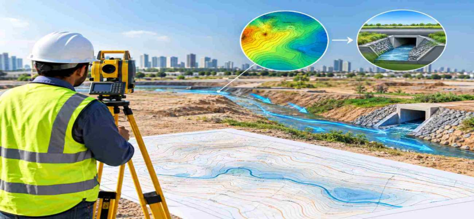
Drainage design begins with understanding the ground. Before engineers decide where stormwater should flow, they need accurate information about the site’s elevation, slope and existing surface features. A topographic survey provides this information and helps the design team understand how the land will influence water movement.
Even a site that appears flat can have small changes in elevation that affect drainage. Water may collect near a building, move towards a road or flow into a low-lying section of the property. Identifying these conditions through a topographic land survey gives engineers a reliable starting point for planning drainage systems.
What Information Does a Topographic Survey Provide for Drainage Design?
A topographic survey records the existing ground levels and physical features across a project site. For drainage planning, the survey must capture the details that influence surface runoff and the connection between the site and its surroundings.
The survey commonly includes:
- Ground levels and spot elevations: Show the height of specific points across the site.
- Contour lines: Illustrate changes in ground elevation and help engineers understand the overall terrain.
- Road and kerb levels: Establish how the site connects with surrounding roads and paved areas.
- Existing drainage features: Locate visible gullies, catch basins, manholes, channels and drainage structures.
- Low points and depressions: Identify areas where rainwater may collect.
- Surface features: Record buildings, boundary walls, paved areas and other elements that influence water movement.
These details form the basis of a topographic survey drawing, which civil engineers use when preparing drainage layouts and grading plans.
How Ground Levels Influence Drainage Paths
Water generally moves from higher ground towards lower ground, following the available slope. However, buildings, walls, roads and changes in the terrain can redirect its path.
A detailed topographic survey helps engineers identify the natural drainage pattern before deciding where runoff should be collected and discharged. It also shows how water might move between different parts of a site and whether neighbouring ground levels could affect the proposed development.
For example, if a proposed building sits beside a lower section of land, the grading design may need to direct surface water away from the building and towards a suitable collection point. Surveyed elevations help engineers assess this relationship instead of relying on visual estimates.
Why Surface Falls Matter in Drainage Planning
Surface fall refers to the change in elevation across a given distance. It determines how the ground slopes and plays an important role in directing rainwater towards drainage inlets or channels.
A surface that falls in the wrong direction may direct water towards entrances, paved areas or building foundations. On the other hand, an unsuitable or insufficient slope may allow water to remain in depressions.
A topographic survey measures the existing levels needed to assess these conditions. Engineers can use the data to develop proposed surface falls for roads, parking areas, footpaths, landscaped spaces and building surroundings.
The required slope depends on the intended use of the area, surface material, drainage arrangement and applicable design criteria. Survey data provides the starting point, while the civil engineer determines the appropriate design levels.
The Role of Contour Lines in Stormwater Drainage Design
Contour lines connect points of equal elevation and provide a clear picture of the site’s shape. Their spacing and pattern help engineers identify steep slopes, gradual changes in terrain and relatively flat areas.
In stormwater drainage design, contour information helps the team understand which areas may contribute runoff to a particular location. It also supports the planning of surface grading, drainage channels and suitable collection points.
For sites with limited natural slopes, detailed spot levels are particularly important. Closely spaced survey observations in critical areas can reveal small elevation differences that may not be apparent from widely spaced contours alone.
The appropriate contour interval and survey detail should be agreed with the design team based on the site conditions and project requirements.
Surveying Existing Drains and Connection Levels
A new drainage system often needs to connect with existing infrastructure. The design team may need information about nearby manholes, drainage chambers, gullies, channels and discharge points.
A topographic survey can record the locations and surface levels of visible drainage features. Where access is available and included in the survey scope, the survey team may also measure pipe invert levels, which indicate the internal bottom elevation of a drain.
These measurements help engineers assess how proposed drainage lines relate to existing infrastructure. They can also identify level differences that may affect the proposed connection.
A survey of visible surface features alone does not establish the complete underground drainage network. Additional chamber inspections, utility surveys or other investigations may be needed to confirm pipe routes, sizes, depths and connectivity.
How Topographic Survey Data Helps Prevent Drainage Problems
Drainage problems can arise when a design does not account for actual ground conditions. Missing levels, incorrect assumptions about existing slopes or incomplete information around site boundaries can lead to changes during construction.
Accurate topographic survey data helps engineers identify potential issues before finalising the drainage layout.
It supports the design team in:
- Identifying low-lying areas that require particular attention.
- Checking how proposed ground levels meet existing road and kerb levels.
- Planning surface grading around buildings and access routes.
- Assessing the relationship between drainage inlets and surrounding elevations.
- Coordinating drainage works with roads, utilities and other site infrastructure.
- Comparing existing ground levels with proposed formation levels.
The survey does not replace hydraulic calculations or drainage capacity assessments. Instead, it gives engineers dependable ground information for carrying out those design checks.
Topographic Survey for Drainage Design on Construction Sites
On construction projects, drainage design must work alongside the building layout, road levels, landscaping and external works. Changes to one area can affect water movement elsewhere on the site.
For example, raising a parking area or changing the finished ground level around a building can alter the direction of surface runoff. If these changes are not coordinated with the drainage layout, water may collect in places where it was not intended to.
A topographic survey provides the existing-condition information needed to coordinate these elements. During planning, it helps establish the relationship between the natural ground and proposed development. Later, additional level surveys can be used to check whether constructed surfaces match the approved design.
For larger developments, the survey may also cover adjoining roads, access points and other surrounding areas that influence drainage across the site.
How Survey Data Is Prepared for Engineering Design
After field measurements are completed, the survey data is processed into drawings and digital information suitable for the engineering team.
Depending on the project requirements, deliverables may include:
- Topographic survey drawings in DWG and PDF formats.
- Spot levels and contour mapping.
- Existing road, kerb and drainage feature details.
- Digital terrain models for understanding the ground surface.
- Coordinate and elevation information tied to the agreed survey reference system.
These deliverables allow civil engineers to work with measured site conditions when preparing grading plans, stormwater layouts and other civil engineering drawings.
The survey extent, required accuracy, coordinate system and drawing format should be confirmed before fieldwork begins. This helps ensure that the information covers the areas needed for the intended design.
Conclusion
A reliable drainage design depends on knowing how the ground actually sits. A topographic survey provides the elevation data, contour information and existing feature locations needed to understand surface runoff and plan suitable drainage arrangements.
By identifying low points, measuring surface falls and recording existing drainage connections, survey data helps engineers develop designs that respond to real site conditions. It also improves coordination between drainage, road design, grading and construction activities.
For consultants, contractors and developers, obtaining the right topographic information early gives the design team a clearer picture of the site before drainage work moves into detailed planning and construction.
Topographic Survey Support for Engineering Projects
Northern Engineering Surveys L.L.C. provides surveying services for construction and infrastructure projects, including topographic surveys, GPS surveys, setting out and as-built surveys. Accurate site measurements help project teams work from reliable ground information when planning drainage, grading and other civil engineering works.
Visit www.nesdubai.com to learn more about the company’s surveying services.
Frequently Asked Questions
1. Why is a topographic survey needed for drainage design?
A topographic survey provides ground elevations, contours and existing feature locations. Engineers use this information to assess surface runoff, plan grading and coordinate proposed drainage systems with existing site conditions.
2. How do contour lines help with stormwater drainage?
Contour lines show how elevation changes across a site. They help engineers identify high and low areas, understand terrain patterns and assess potential surface water flow paths.
3. What ground levels are important for drainage planning?
Important measurements include spot elevations, low points, road and kerb levels, surface falls and levels around drainage structures. The required details depend on the proposed drainage layout and site conditions.
4. Can a topographic survey identify areas where water may collect?
Yes. Ground levels and contours can reveal depressions and low-lying areas where water may accumulate. Actual drainage performance also depends on rainfall, surface materials, soil conditions and the capacity of the drainage system.
5. Does a topographic survey include underground drainage pipes?
Not necessarily. A standard topographic survey usually records visible surface features. Pipe routes, depths and invert levels may require additional measurements, chamber inspections or a dedicated utility survey, depending on accessibility and scope.
6. What is the difference between a topographic survey and a drainage survey?
A topographic survey records ground elevations and physical features across a site. A drainage survey focuses more specifically on drainage infrastructure, which may include pipe routes, chamber details, invert levels and connections. Some projects require both surveys to support the design.