
Top Surveying Equipment for Land Surveying
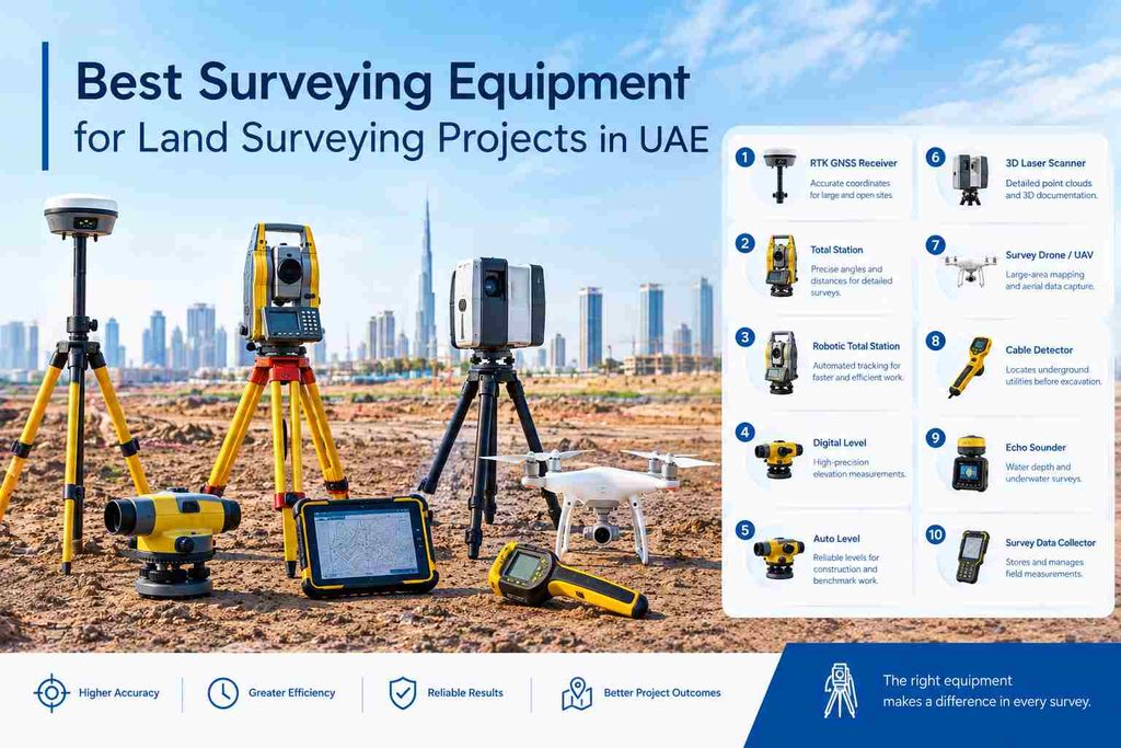
Land surveying depends on the type of site, the required accuracy and the information that needs to be collected. A large open plot may need GNSS equipment, while detailed work around buildings may require a Total Station or 3D scanner.
Here are 10 commonly used surveying tools for land and construction survey work.
1. RTK GNSS Receiver
RTK GNSS receivers are used to determine accurate ground coordinates using satellite positioning. They are useful for large open sites, topographic surveys, road corridors, control points and boundary-related work.
They can collect points quickly without setting up an instrument at every location. However, good satellite visibility and a suitable correction source are important for reliable results.
2. Total Station
A Total Station measures horizontal angles, vertical angles and distances to determine the position of survey points.
It is widely used for topographic surveys, setting out, boundary surveys, building layout and construction control. It is particularly useful when the survey requires precise measurements between known points.
NES already uses Total Stations extensively, with its current equipment page listing 30 Total Stations.
3. Robotic Total Station
A Robotic Total Station adds automated movement and target tracking to conventional Total Station work.
It can be useful when a surveyor needs to work efficiently with fewer manual instrument adjustments. These instruments are commonly used for construction layout, monitoring and detailed site measurements.
The main benefit is not simply automation. The instrument still needs correct control, setup and field checks.
4. Digital Level
A Digital Level is designed for precise elevation measurements.
It is useful when a project requires reliable height information for benchmarks, level transfer, road works, structural work and vertical control.
Unlike general positioning equipment, its main purpose is elevation rather than collecting a complete three-dimensional site map.
5. Automatic Level
An Automatic Level, often called an Auto Level, is a practical instrument for transferring and checking elevations across a site.
It can be used for:
- Formation levels
- Road and pavement works
- Foundation levels
- Drainage levels
- Benchmark transfer
- General construction level checks
It remains useful for routine levelling work where a full GNSS or Total Station setup is unnecessary.
NES’s equipment inventory includes a large number of Auto Levels as well as Digital Levels.
6. 3D Laser Scanner
A 3D Laser Scanner captures large numbers of points from surfaces and creates detailed point cloud data.
It is useful for building surveys, as-built documentation, complex structures, MEP areas, industrial sites and projects where a large amount of existing geometry needs to be recorded.
The scanner does not replace every conventional survey method. It is most useful when detailed three-dimensional documentation is required. NES already has dedicated 3D scanning content, so this section should remain focused on the equipment rather than becoming another full 3D scanning guide.
7. Survey Drone / UAV
A survey drone can collect aerial images and other data across large areas.
With suitable survey equipment and processing, the collected data can support orthomosaic mapping, terrain modelling, stockpile measurement and large-area site documentation.
Drones can cover areas that would take much longer to survey point by point from the ground. Ground control and appropriate flight planning are still important when accuracy is required.
NES currently lists a drone in its survey equipment inventory.
8. Cable Detector
A Cable Detector is used to help locate underground services before excavation.
It can be useful around construction sites where existing utility routes need to be investigated. Depending on the equipment and site conditions, the survey team may use it to trace buried cables or identify possible underground service routes.
This makes it particularly relevant before excavation, road works and utility construction.
9. Echo Sounder
An Echo Sounder is used for measuring water depth and collecting underwater elevation information.
It is mainly relevant to hydrographic and marine surveying, rather than ordinary land surveying. It becomes useful for projects involving canals, coastlines, waterfront developments, reservoirs or other water bodies.
NES’s current equipment list includes Echo Sounders, reflecting its use in surveying work beyond dry-land sites.
10. Survey Data Collector
A survey data collector connects field measurements with digital survey data.
It allows surveyors to store points, enter codes, review observations and manage field data while working with instruments such as GNSS receivers and Total Stations.
A good field controller can make a difference when hundreds or thousands of points are collected. Clear point codes and organised field data also make the office processing stage easier.
Which Surveying Equipment Is Used for What?
| Equipment | Main use |
| RTK GNSS Receiver | Coordinates, topographic surveys, control |
| Total Station | Precise points, setting out, construction surveys |
| Robotic Total Station | Automated construction and detailed surveys |
| Digital Level | Precise elevation control |
| Auto Level | Routine level and benchmark work |
| 3D Laser Scanner | Point clouds and detailed 3D documentation |
| Survey Drone | Large-area aerial mapping |
| Cable Detector | Underground cable/service detection |
| Echo Sounder | Hydrographic and underwater surveys |
| Survey Data Collector | Field data recording and instrument control |
Need the Right Surveying Support for Your Project?
Northern Engineering Surveys L.L.C. provides surveying services for construction, infrastructure and land development projects in Dubai and across the UAE.
Our services include Topographic Survey, Land Surveying, GPS/GNSS Survey, Total Station Survey, 3D Laser Scanning, Setting Out, As-Built Survey, Volume Calculation and Control Point Surveys.
FAQs
1. What equipment is commonly used for land surveying?
Common land surveying equipment includes RTK GNSS receivers, Total Stations, Robotic Total Stations, Digital Levels, Auto Levels, 3D Laser Scanners, survey drones and field data collectors.
2. Which surveying equipment is used for accurate land coordinates?
An RTK GNSS receiver is commonly used to establish accurate ground coordinates. A Total Station can also be used where precise local measurements are required.
3. When is a Total Station used in land surveying?
A Total Station is used for measuring angles and distances for applications such as topographic surveys, boundary surveys, construction setting out and site control.
4. What is the difference between a Digital Level and an Auto Level?
Both are used for elevation and levelling work. A Digital Level provides electronic readings and can support high-precision levelling, while an Auto Level uses an optical system for routine elevation measurements.
5. Can 3D laser scanners be used for land surveying?
Yes. 3D laser scanners can capture dense point-cloud data for existing-condition surveys, buildings, structures, as-built documentation and areas where detailed three-dimensional information is required.
6. How do surveyors choose the right surveying equipment for a project?
Equipment selection depends on the required accuracy, site size, terrain, visibility, survey type, control network and final deliverables. A surveyor may use more than one instrument on the same project to obtain the required measurements.