
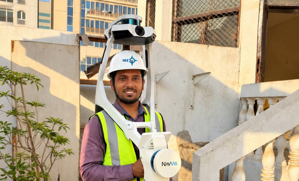
Construction sites need scanning equipment that can cover large areas while the surveyor moves through different rooms, floors and site conditions. NavVis VLX 2 is a wearable mobile mapping system used by our survey team for 3D site capture.
Why NavVis VLX 2 Is Suitable for Construction Surveying
1. Wearable Mobile Scanning
Unlike a conventional tripod-mounted scanner, the NavVis VLX 2 is worn by the surveyor. This allows the operator to walk through the site while capturing spatial data, making it practical for large and connected areas.
2. LiDAR + 360° Imagery
The system combines LiDAR scanning with panoramic imagery. This provides both 3D spatial information and visual reference from the same site visit.
3. Large-Area Site Capture
NavVis VLX 2 has an operational LiDAR range of up to 50 m and uses two LiDAR scanners for mobile data capture. This makes it suitable for capturing large building interiors and connected construction areas.
4. Point Cloud Data
The captured information can be processed into a registered point cloud for survey measurements, CAD extraction and other downstream applications. NavVis supports formats including E57, LAS, PTS, XYZ and PLY.
5. Survey Control
For projects requiring controlled survey information, the VLX 2 can work with ground and wall control points, allowing the mobile scan to be connected with established survey control.
Where We Use 3D Laser Scanning
At Northern Engineering Surveys L.L.C. (NES Dubai), 3D laser scanning is used to capture existing site conditions for construction and engineering projects.
Our scanning services can support:
- Building and site documentation
- Existing-condition surveys
- As-built documentation
- Point cloud generation
- CAD extraction
- BIM-related survey requirements
- Structural and architectural documentation
- Large-area construction site capture
The scanning method and equipment are selected according to the site size, accessibility, accuracy requirement and final deliverable.
3D Laser Scanning Services in UAE
At NES Dubai, we combine 3D laser scanning with surveying knowledge and site control to produce usable survey data for project teams.
If your project requires detailed existing-condition data, point clouds or 3D laser scanning for construction documentation, our survey team can plan the appropriate scanning method for the site.
Need 3D Laser Scanning for your construction project in UAE?
Northern Engineering Surveys L.L.C. provides Topographic Surveys, 3D Laser Scanning, Volume Calculation, As-Built Surveys, and Point Cloud Services for construction and engineering projects in the UAE.