
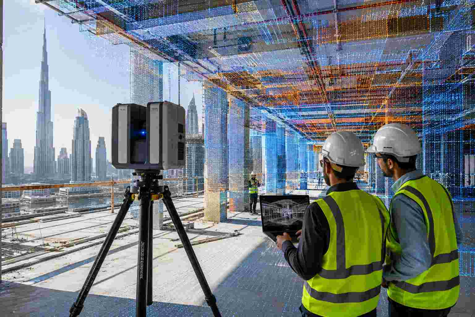
Ever had a project stall because the drawings didn’t match reality on site? That’s usually where 3D scanning comes in. This guide covers what it actually does, how contractors and architects use it in Dubai, and what to check before choosing a provider.
What Actually Happens When You “Scan” a Site
A laser scanner sends out beams that bounce off surfaces and record where they land. Do this from multiple positions and you get millions of measured points — a point cloud — that captures the site’s geometry in high detail. Depending on the scanner, range, site conditions, and registration workflow, the data can provide millimetre-level detail. The principle is straightforward: multiple scan positions are combined to create a detailed spatial record of the site.
Why This Is Getting More Common on Dubai Sites
Dubai’s building activity continues to drive demand for faster and more reliable site measurement. With a large volume of construction and development work underway, 3D scanning can help project teams identify dimensional differences, coordination issues, and existing-condition conflicts before they lead to rework or delays.
For complex projects, identifying clashes and dimensional discrepancies before installation can reduce rework, coordination problems, and site delays.
For Contractors: Where This Actually Helps On-Site
- Checking progress against the drawings without a manual re-measure every time
- Catching MEP-vs-structural clashes before pipes and beams end up in the same spot
- Confirming subcontractor work matches spec before sign-off
- Getting excavation and stockpile volumes without sending someone out with a tape
- Producing as-built records the client can actually rely on at handover
For Architects: Where It Fits Into Design Work
- Renovation jobs where the original drawings are missing, wrong, or 20 years out of date
- Facade or heritage detail work you don’t want to touch by hand
- Checking a finished build against what was actually designed
- Cutting down the weeks usually spent on manual site measurement
The Process, Without the Jargon
- Someone walks the site first to figure out how many scan positions are needed
- The scanner runs — a small area might take under an hour, while a full building could take a couple of days depending on size, access, and required detail
- All the individual scans get registered and combined into one dataset
- The raw scan gets cleaned up — stray objects, noise, and unwanted data are removed
- The final output is prepared: 2D drawings, a point cloud, 3D model, or BIM-ready files, depending on what you asked for
Picking a 3D Scanning Company in Dubai
A few things worth checking before you sign anything:
- Do they understand the relevant Dubai Municipality and RTA requirements for your project, or will you be handling that separately?
- What scanner are they using, and what accuracy and range does it provide under the expected site conditions?
- Can they hand over files in the format your team already works with?
- Have they completed a project close to your scale before — not just “we do scanning”?
- Will they give you a clear timeline for fieldwork, processing, and delivery before starting?
Where Projects Usually Go Wrong
- Gaps in coverage — usually from restricted access nobody planned for. Sort out scan points before the crew shows up.
- Too much raw data — a raw point cloud can be a large and difficult file to use on its own. Ask for a cleaned and properly registered dataset, not just the raw export.
- Wrong file format — confirm compatibility with your CAD or BIM software before the scan, not after delivery.
- Underestimating time on big sites — larger or more complex buildings take longer to scan, register, check, and process. Build that into your schedule early, not as an afterthought.
- Insufficient survey control — if the project requires accurate coordinates or integration with existing survey data, confirm the control and georeferencing requirements before scanning begins.
3D Scanning Does Not Always Replace a Land Survey
3D laser scanning provides detailed geometric information about existing conditions, but it does not automatically replace a controlled land survey. Projects that require established coordinates, elevations, boundaries, or specific survey control may need GNSS, total station, or other conventional survey methods alongside scanning.
Confirm the required accuracy, coordinate system, control points, and final deliverables before the survey team starts work.
What Drives the Price
Cost isn’t fixed — it moves based on:
- Site size and how complicated the layout is
- Whether you need a basic point cloud or a full BIM model
- How hard the site is to access (live sites cost more to schedule around)
- The level of accuracy and survey control required
- What format you want the final files in
- How fast you need it turned around
For large construction projects, including 3D scanning in the project scope from the beginning can help teams plan the required fieldwork, processing, and deliverables more effectively.
Need accurate 3D scanning for your next project? Contact NES Dubai.