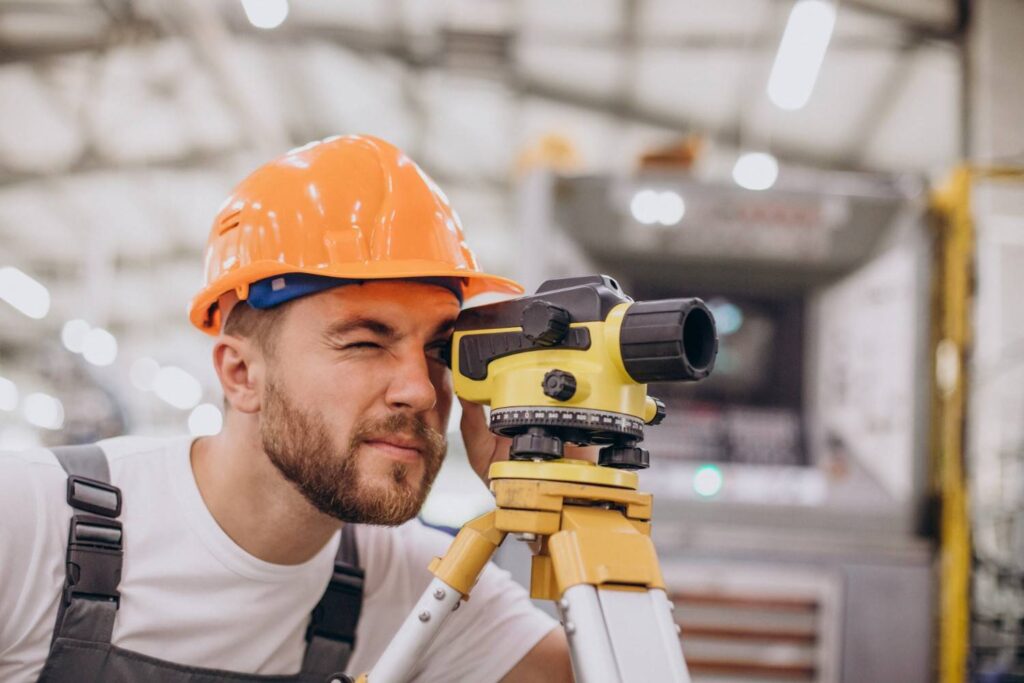
In Dubai, surveying is key to the city’s growth, with over 2,000 kilometers of roads relying on precise measurements for construction. 80% of major projects need surveys to define boundaries and plan structures, fueling the real estate boom. Surveying also plays a crucial role in the real estate and infrastructure sectors, which contribute significantly to the city’s GDP. Additionally, 90% of new developments undergo surveys to meet Dubai Land Department regulations and zoning laws. Surveyors are behind-the-scenes professionals ensuring that everything, from city streets to properties, is accurately measured and mapped.
The Role of Surveyors: Measuring the World
Surveyors specialize in determining the precise positions and boundaries of land, structures, and physical features. Using advanced tools, technology, and mathematics, they gather data to create essential maps, plans, and legal documents. Their work supports industries like construction, real estate, and urban planning, ensuring everything is built to exact specifications.
The Key Pillars of a Surveyor’s Work:
- Defining Property Boundaries (Cadastral Surveying): This is perhaps the most familiar aspect. Surveyors are the guardians of property lines. They meticulously research historical records, interpret complex deeds, and use cutting-edge technology to establish and re-establish property corners, lines, and easements. This work is absolutely critical for real estate transactions, preventing costly disputes, and ensuring legal ownership for homeowners and developers alike.
- Topographic Mapping: Ever marveled at a detailed contour map? That’s the handiwork of a topographic surveyor. They measure and map the natural and artificial features of a land area, capturing everything from subtle changes in elevation to the precise location of rivers, roads, and buildings. This invaluable data is the bedrock for urban planning, architectural design, environmental studies, and just about any project that interacts with the lay of the land.
- Construction Layout: Before the first bulldozer even breaks ground on a new skyscraper, a sprawling shopping mall, or a critical bridge, surveyors are on site. They translate the detailed architectural and engineering designs onto the physical ground, marking the exact locations for foundations, utilities, walls, and every other structural element. Their unparalleled precision ensures that structures are built exactly to specification, avoiding costly errors and ensuring structural integrity.
- Geodetic Surveying: On a grander, global scale, geodetic surveyors account for the Earth’s curvature. They deal with vast geographical areas and require ultra-high precision measurements. This specialized field is crucial for establishing national and international control networks, monitoring subtle crustal deformations, and even supporting the accuracy of our everyday satellite navigation systems.
- Hydrographic Surveying: For any project involving water – think new ports, dredging shipping channels, or laying vital underwater pipelines – you need a hydrographic surveyor. They map the seabed, measure water depths, identify underwater obstructions, and chart coastlines. This critical data is indispensable for safe navigation, marine construction, resource management, and environmental protection in our oceans and waterways.
- Volumetric Surveys: Need to determine the exact amount of material in a massive stockpile, or precisely how much earth has been excavated from a site? Surveyors utilize their instruments to calculate precise volumes. This is a vital service for mining operations, large-scale construction projects, and effective resource management.
The Modern Surveyor’s Toolkit: Precision Powerhouses
While the fundamental principles of measurement endure, the tools of the trade have been revolutionized. Today’s surveyors are masters of sophisticated technology:
- Total Stations: These electronic marvels measure angles and distances with astonishing accuracy, forming the backbone of many surveying tasks.
- GPS/GNSS Receivers: Leveraging satellite signals, these devices determine precise coordinates on Earth, enabling rapid and accurate positioning.
- LiDAR (Light Detection and Ranging): By emitting millions of laser pulses, LiDAR systems create incredibly detailed 3D models of landscapes, buildings, and infrastructure.
- Drones (UAVs): Equipped with high-resolution cameras and various sensors, drones offer efficient aerial mapping and data collection over large areas.
- 3D Laser Scanners: These powerful tools capture millions of data points, generating highly detailed point clouds for precise modeling of existing conditions, crucial for renovation and planning.
Why Their Role is Truly Indispensable
The depth and breadth of a surveyor’s work underscore their critical importance to our society. They provide the fundamental, irrefutable data for:
- Property Security: Providing clear, legally defensible, and undisputed land ownership.
- Safe and Compliant Construction: Guiding the precise placement of every element, ensuring structural integrity and adherence to design.
- Efficient Infrastructure Development: Laying the groundwork for the accurate planning and construction of our roads, bridges, railways, and essential utility networks.
- Responsible Resource Management: Offering precise data for assessing land use, mineral deposits, water resources, and agricultural planning.
- Environmental Stewardship: Monitoring changes in the landscape, supporting conservation efforts, and mapping natural hazards.
The next time you see someone carefully peering through a tripod on the side of the road, remember the silent, crucial work they are doing. Companies like Northern Engineering Survey LLC and others are the backbone of precision in development. From defining the exact boundaries of your home to charting the path for vital pipelines across vast landscapes, surveyors are the hidden architects of precision, diligently laying the groundwork for a safe, organized, and developed world. They are, quite simply, indispensable.
