Ever wonder why some construction projects seem to go off the rails, despite meticulous planning? Or why a seemingly straightforward landscaping job ends up costing a fortune in rework? Often, the culprit is something surprisingly fundamental: overlooking the critical role of elevation in surveying. It’s a silent project killer, and if you’re not paying close attention, your project might be next. Studies show that rework costs in construction can account for anywhere from 5% to 20% of the total project value, with some estimates suggesting it could reach as high as 30% in the UK. A significant portion of this can be attributed to design and surveying errors, including inaccurate elevation data. In fact, research by the Construction Industry Institute (CII) reveals that direct costs caused by rework average 5% of total construction costs, amounting to billions annually.
What’s the Big Deal About Elevation Anyway?
At its core, elevation refers to the vertical distance of a point or object above or below a reference datum, usually mean sea level. In surveying, we use various techniques to accurately determine these heights. But why is this so crucial? Think of it this way:
- Foundation Fails: Imagine building a multi-story building where one corner’s foundation is slightly lower than the others due to inaccurate elevation data. Over time, this can lead to stress, cracks, and eventually, structural failure. The infamous Leaning Tower of Pisa is a historic example of a building constructed on unstable ground due to an inaccurate land assessment.
- Drainage Disasters: For roads, pipelines, or even simple landscaping, proper drainage is paramount. If your elevation measurements are off, water won’t flow as intended, leading to pooling, erosion, and expensive water damage.
- Costly Rework: Misjudged elevations often result in materials being ordered incorrectly, equipment being positioned improperly, and tasks needing to be redone. This translates directly into budget overruns and schedule delays.
- Regulatory Roadblocks: Many construction codes and environmental regulations have strict requirements regarding elevation, especially for flood plains or critical infrastructure. Ignoring these can lead to legal issues and project shutdowns.
More Than Just “Higher” or “Lower”: The Nuances of Elevation Data
It’s not enough to simply know if something is “higher” or “lower.” Professional surveying involves precise measurements and considerations:
- Datums: Understanding the reference point (like local or global datums) used for elevation is vital. Inconsistencies between datums can lead to significant errors.
- Accuracy vs. Precision: While related, these are distinct. Accuracy refers to how close a measurement is to the true value, while precision refers to how close repeated measurements are to each other. Both are essential for reliable elevation data.
- Error Propagation: Errors in elevation measurements can accumulate and magnify as a project progresses, leading to larger discrepancies down the line.
Are YOU Ignoring Elevation? Signs to Watch For!
How can you tell if your project is at risk?
- Budget Blowouts: Are unexpected costs piling up related to groundworks, drainage, or material quantities?
- Schedule Slippages: Is your project constantly facing delays due to unforeseen site conditions or rework?
- Equipment Malfunctions: Is machinery struggling to achieve proper grades or depths?
- Visible Issues: Do you see standing water where there shouldn’t be, or noticeable slopes that don’t look right?
If any of these sound familiar, it’s time to take a hard look at your elevation surveying practices.
The Solution: Prioritize Professional Elevation Surveying! ✅
The good news is that preventing these collapses is entirely achievable by giving elevation the attention it deserves.
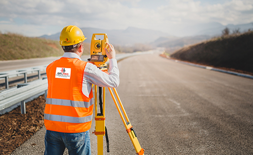
- Invest in Expertise: Hire qualified and experienced land surveyors who specialize in precise elevation measurements. They possess the knowledge, equipment, and techniques to ensure accuracy.
- Utilize Advanced Technology: Modern surveying uses tools like GPS/GNSS, total stations, and even drones with LiDAR technology to capture highly accurate elevation data.
- Regular Checks and QA/QC: Implement rigorous quality assurance and quality control procedures throughout the project lifecycle to verify elevation data at various stages.
- Clear Communication: Ensure all stakeholders—architects, engineers, contractors, and project managers—understand the importance of elevation data and how it impacts their work.
Don’t let a foundational element like elevation be the undoing of your project. By recognizing its critical role and prioritizing accurate surveying, you can build with confidence, avoid costly mistakes, and ensure your project stands strong for years to come with the help of experts like Northern Engineering Survey LLC