
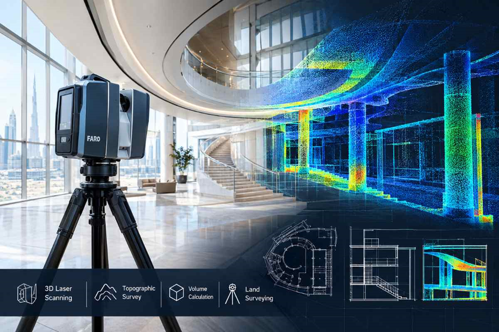
Measuring a building is straightforward when the layout consists mainly of straight walls, regular rooms, and accessible surfaces. The work becomes more demanding when the structure includes curved walls, sloped surfaces, split levels, irregular columns, large voids, or architectural features that are difficult to reach.
3D LiDAR scanning provides a way to record these conditions as spatial survey data. Instead of taking dimensions one feature at a time, the scanner captures the surrounding surfaces from planned positions. The resulting data can then be examined to obtain dimensions, profiles, levels, and other geometric information.
For complex buildings in Dubai, this approach is useful when existing drawings are incomplete, when the actual construction differs from available drawings, or when design teams need reliable measurements of unusual building geometry.
1. Why Complex Building Geometry Is Difficult to Survey
A conventional measurement approach works well for simple layouts. Complex buildings create a different set of survey requirements because the geometry cannot always be described with a small number of dimensions.
Typical problem areas include:
- Curved or non-linear walls
- Sloping floors and ceilings
- Irregular structural members
- Split-level floor areas
- Large atriums and vertical voids
- Angled walls and partitions
- Circular or curved staircases
- Architectural projections
- Areas above normal working height
For example, measuring a curved wall with a tape or individual point measurements gives only selected positions along the wall. It may not provide enough information to reproduce the actual profile accurately.
The same problem occurs with sloping ceilings, irregular columns, and structures where the relationship between several elements matters.
A LiDAR survey records the spatial position of visible surfaces across the survey area. This gives the survey team a larger measurement dataset to work with when preparing plans, sections, elevations, and other required information.
2. 3D LiDAR Scanning for Curved and Irregular Structures
Curved and irregular structures require measurements along their actual profiles. Recording only the start and end points can leave out important changes in shape.
3D LiDAR scanning can capture geometry such as:
- Curved architectural walls
- Arched openings
- Domed ceilings
- Vaulted areas
- Circular staircases
- Sloping structural elements
- Angled partitions
- Irregular façade profiles
- Non-orthogonal building layouts
The captured points retain the position of the surveyed surfaces. Surveyors can use the data to inspect the geometry from different views and extract measurements at selected locations.
For instance, when an architect needs to modify an existing curved wall, the survey data can provide a detailed profile of the wall rather than relying on a limited number of manually measured offsets.
This is particularly useful where the existing geometry has to be transferred into drawings for renovation or modification work.
3. Capturing Multi-Level Building Geometry with LiDAR
Some buildings cannot be represented accurately using separate floor plans alone. A mezzanine may connect two levels, a staircase may pass through several floors, or an atrium may extend through multiple storeys.
These relationships are important when preparing drawings or checking existing construction.
Areas that can require detailed measurement include:
- Split-level floors
- Mezzanines
- Staircases and landings
- Atriums
- Double-height spaces
- Ramps
- Vertical shafts
- Floor openings
- Sloped access areas
- Floor-to-floor transitions
The survey data allows these elements to be viewed together instead of treating every level as an isolated measurement exercise.
This can help identify differences in floor elevations, vertical clearances, stair geometry, and connections between adjoining spaces.
For renovation projects, this information can be useful before new partitions, floors, ceilings, stairs, or other architectural elements are designed.
4. Surveying Hidden Building Geometry Behind Architectural Features
Not every part of a building is visible from a single position. Columns, partitions, balconies, ceiling features, and other architectural elements can block surfaces from view.
For complex building surveys, the important consideration is which surfaces are visible from each scan position.
Areas that may require additional attention include:
- Surfaces behind partial partitions
- Areas beneath balconies
- Spaces around stair cores
- Geometry around structural columns
- Ceiling areas above architectural features
- Narrow gaps between building elements
- Recessed wall sections
- Areas around projecting structures
The survey team can select additional positions where required to record surfaces that are not visible from the first set of locations.
This is a field-planning issue rather than a software feature. If a surface is physically blocked, it cannot be recovered from the scan data. The required coverage therefore needs to be considered while the survey is being carried out.
A site coverage check before demobilisation can help identify missing areas while the survey team is still on site.
5. Reading Complex Building Geometry from LiDAR Point Clouds
Once the survey data has been processed, the point cloud can be examined to understand the building’s actual geometry.
For complex structures, useful measurements may include:
- Wall alignment
- Curved wall profiles
- Floor-to-ceiling heights
- Opening dimensions
- Column positions
- Stair widths and rises
- Slab levels
- Floor slopes
- Structural offsets
- Distances between building elements
Different viewing directions can reveal information that is difficult to identify from a conventional plan.
For example, a section through an irregular ceiling can show changes in height across the room. A vertical section through a curved façade can show its actual profile. A plan view can help check the position of walls, columns, and openings.
The point cloud can therefore be used as a measurement reference when producing survey drawings or checking existing documentation.
6. Detecting Dimensional and Geometric Deviations from LiDAR Data
Existing construction does not always correspond exactly with the original drawings. Changes made during construction, later modifications, repair work, and undocumented alterations can produce differences between the drawing and the building on site.
LiDAR data can be used to investigate these differences.
Depending on the survey scope, checks may include:
- Wall position deviations
- Floor-level differences
- Slab alignment
- Column offsets
- Out-of-plumb elements
- Ceiling-level variations
- Irregular structural profiles
- Differences between recorded and documented dimensions
A typical checking sequence is:
Survey capture → Data registration → Point-cloud quality check → Geometry extraction → Comparison → Deviation assessment
For example, an existing wall shown at a particular position on an old drawing can be compared with its surveyed position. The same approach can be applied to floor levels, columns, openings, or other measurable elements.
The acceptable deviation should not be assumed from the scanning method alone. It needs to be established according to the project requirements, survey specification, instrument capability, site conditions, and required drawing accuracy.
7. What Survey Data Can Be Extracted from Complex Building Geometry
The survey requirement should be defined before fieldwork because the final drawings and measurements determine how the building needs to be captured.
Depending on the project, useful outputs can include:
- Floor plans of irregular layouts
- Building sections
- Internal elevations
- Façade profiles
- Floor and ceiling levels
- Wall and opening dimensions
- Curved surface profiles
- Structural geometry references
- 3D measurement data
- Registered point-cloud data
- CAD survey drawings
- BIM-compatible survey information where required
For renovation and refurbishment work, the survey data can provide a measured reference of the existing geometry before design changes are made.
For architectural and engineering teams, the value is not simply having a 3D scan. The important part is obtaining usable measurements from the captured geometry and presenting them in the format required for the next stage of the project.
On complex Dubai building projects, the survey scope should therefore define the areas to be captured, required accuracy, control requirements, coverage, and final deliverables before scanning begins.
Surveying Services by NES Dubai
Northern Engineering Surveys L.L.C. (NES) provides reliable surveying services in Dubai, including 3D Laser Scanning, Topographic Survey, Volume Calculation, Land Surveying, and Total Station Survey.
Contact NES Dubai for your surveying requirements.