The land survey equipment market is experiencing a period of significant growth, fueled by a global push for new construction and infrastructure projects. Valued at an estimated $9.06 billion in 2023, the market is projected to reach $13.5 billion by 2030, with a compound annual growth rate (CAGR) of 5.9% . This robust growth underscores the increasing reliance on advanced and accurate tools to shape our modern world.
🧭 Foundational Tools: Total Stations & Theodolites
- Total Station: This is the workhorse of modern surveying. A total station is a sophisticated electronic device that measures both horizontal and vertical angles and distances. It combines a digital theodolite with an electronic distance meter (EDM) in one compact unit. Total stations are incredibly versatile, used for everything from creating detailed topographic maps to laying out construction sites with millimeter-level precision.
- Theodolite: While total stations have largely taken over, theodolites are still crucial for specific tasks. These optical instruments are designed to measure horizontal and vertical angles with a high degree of accuracy. They are fundamental for tasks that require precise angular measurements, such as establishing property lines or aligning structural components.
🛰️ High-Tech Solutions: GPS/GNSS & Drones
- GPS/GNSS Receivers: Professional-grade Global Navigation Satellite System (GNSS) receivers are a game-changer for large-scale surveying. Using signals from multiple satellite constellations (including GPS, GLONASS, and Galileo), these systems can pinpoint a location on Earth with exceptional accuracy. They are vital for establishing control points and conducting wide-area mapping projects efficiently.
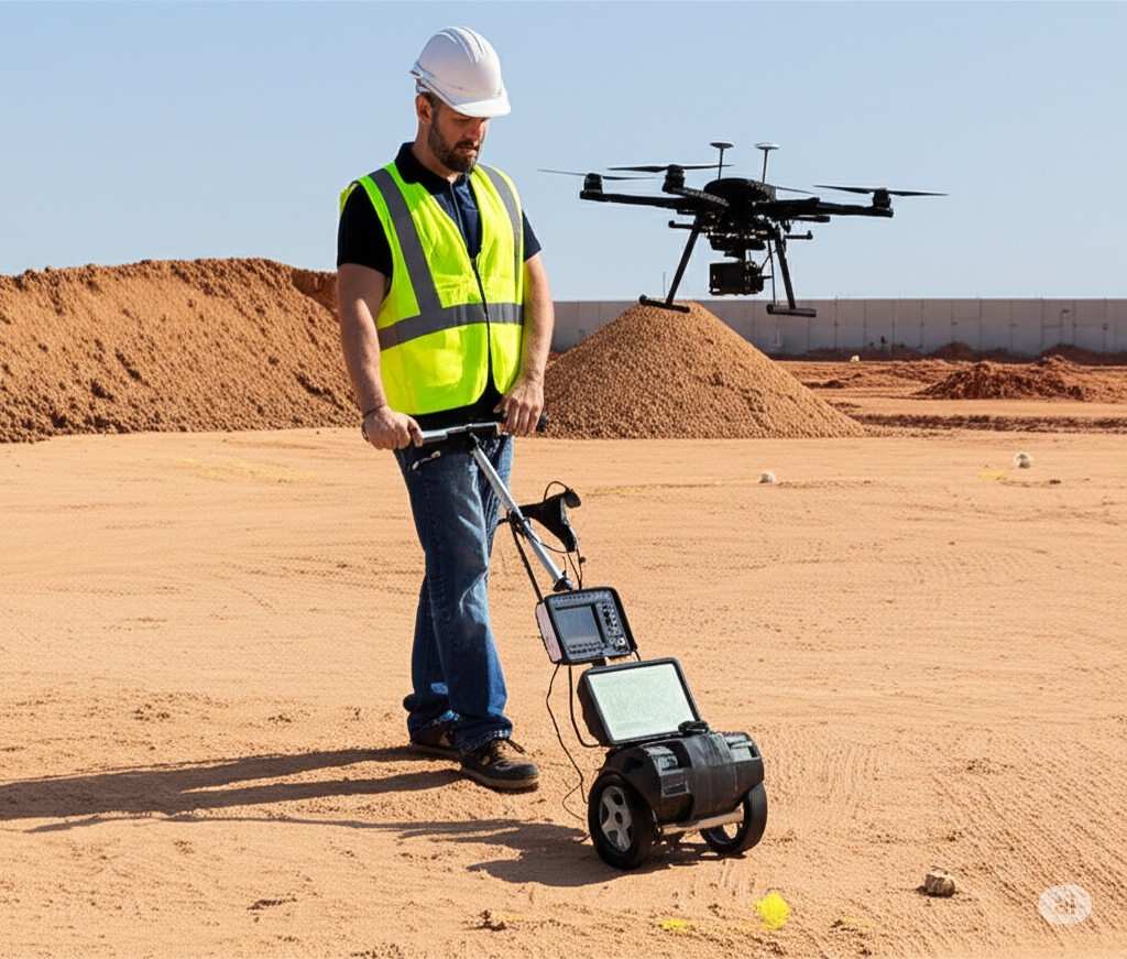
- Drones (UAVs): Unmanned Aerial Vehicles, or drones, have revolutionized the way surveyors collect data. Equipped with high-resolution cameras and LiDAR sensors, they can capture vast amounts of data from above, creating detailed 3D models and orthomosaic maps of large or inaccessible areas. This technology has significantly reduced the time and effort required for many types of surveys, such as construction site monitoring and volumetric calculations.
📏 Specialized and Complementary Equipment
- Levels: These instruments are used to measure elevation and establish a horizontal plane.
- Automatic (Auto) Levels: These are common in construction due to their self-leveling mechanism, which makes them easy to use.
- Digital Levels: These provide a digital readout of measurements, minimizing human error and increasing speed.
- 3D Laser Scanners: These devices use a laser to capture millions of data points, creating a highly detailed “point cloud” that represents an environment in three dimensions. They are essential for documenting existing conditions, historic preservation, and creating “as-built” models of buildings and infrastructure.
- Prisms and Reflectors: These passive components are used with total stations. A prism reflects the total station’s laser beam back to the instrument, enabling it to accurately measure the distance to the target.
- Tripods: A stable, three-legged stand, a tripod is used to support and level surveying instruments, ensuring the accuracy of all measurements.
For all your ground surveying needs, trust the expertise and advanced equipment of Northern Engineering Survey LLC.