Choosing the right land survey service is a critical first step for residential, commercial, and construction projects. From defining property boundaries to advanced 3D mapping, modern land surveying combines legal precision with cutting-edge technology. This guide answers the most common questions about land survey services—helping you make an informed decision for your next project.
What Makes a Land Survey Service Reliable?
When searching for “surveyors near me,” reliability is measured by more than just a quick turnaround. A reputable firm should be:
- Licensed and Certified: They must hold the proper credentials from state or national professional boards.
- Locally Experienced: Familiarity with regional land laws, historical markers, and zoning regulations is invaluable.
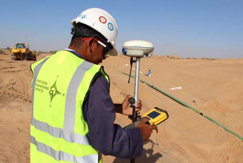
- Technologically Advanced: They should utilize modern tools like GNSS (Global Navigation Satellite Systems), drones, and robotic total stations.
- Transparent: Look for firms with documented customer testimonials and a clear portfolio of past projects.
What’s Included in a Standard Residential Survey?
If you are building a fence, adding an extension, or buying a home, a residential survey typically includes:
- Boundary Identification: Locating or resetting physical iron pins at property corners.
- Structure Mapping: Precisely measuring the location of houses, garages, and sheds.
- Improvement Location: Identifying fences, driveways, and walls in relation to the property line.
- Official Plat/Map: A certified drawing that can be used for building permits or legal records.
Boundary vs. Topographic Surveys: Which Do You Need?
Understanding the difference is key to hiring the right team:
- Boundary Survey: Focuses on the “horizontal” legal limits of ownership. It answers the question: “Where is my land?”
- Topographic Survey: Focuses on the “vertical” features of the land. It maps elevations, contour lines, trees, and man-made utilities. It answers the question: “What does the land look like?”
Pro Tip: Most construction projects require both to ensure the building is on the right lot and at the correct height for drainage.
Specializations in Modern Surveying
The industry has evolved beyond simple stakes in the ground. Many firms now offer specialized digital services:
- Drone-Based Surveying (UAV): Perfect for large land parcels or dangerous terrain, providing high-resolution aerial imagery and rapid data collection.
- 3D Mapping and BIM: Surveyors can create “Digital Twins” of land or structures, providing 3D models that integrate directly into architectural software (Building Information Modeling).
- GIS Data Integration: For urban planning or large infrastructure, surveyors provide data that plugs into Geographic Information Systems for long-term land management.
- Environmental & Flood Assessment: Some firms provide flood risk analysis and land suitability studies, essential for securing insurance or environmental permits.
The Hiring Process: Timeline and Verification
How long does it take? While a small residential lot might be completed in 1–3 business days, larger commercial sites or complex boundary disputes can take several weeks depending on the depth of historical research required at the county records office.
How to verify credentials: Never take a “handshake” deal. Always:
- Check the firm’s License Number against your state’s professional licensing board.
- Ensure they carry Professional Liability Insurance.
- Ask for a written contract that defines the “Scope of Work” and the final deliverables (e.g., a signed and sealed map).
Conclusion
Land survey services are the foundation of safe, legal, and accurate construction. Whether you need a simple boundary line for a new fence or advanced 3D modeling for a smart city project, the right professional ensures your project stays on track and out of the courtroom.