
Surveyor Dubai: How Survey Teams Handle Changes During Construction
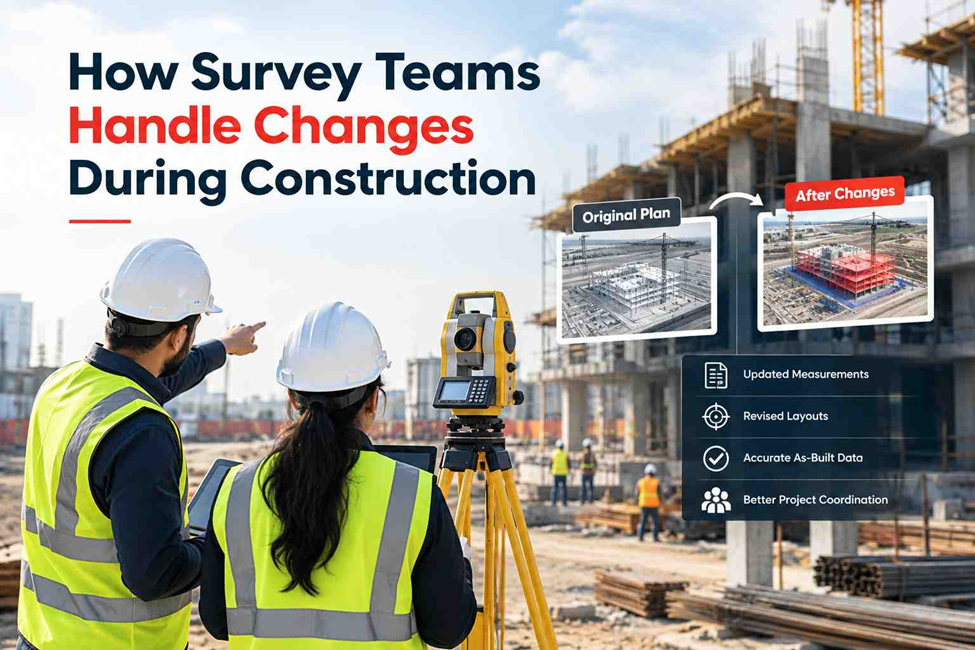
Construction drawings show the intended design, while site conditions show what has actually been built. As work progresses, differences can occur due to design revisions, changed levels, shifted elements or existing conditions.
A surveyor in Dubai measures these changes, verifies coordinates and levels, and provides reliable site data for the next stage of construction. This helps different project teams work from accurate, current information.
What Causes Changes During Construction?
Changes can occur for many reasons.
Some come from the design team. Others are discovered only after construction begins.
Common examples include:
- Revised architectural or structural drawings
- Changes to column or wall positions
- Differences between existing conditions and old drawings
- Adjustments to finished floor levels
- Unexpected site conditions
- Utility conflicts
- Changes to road or access levels
- Structural modifications
- Coordination changes between MEP and structural works
- Corrections following inspection or verification
A survey team needs to know which information is current before transferring revised coordinates or levels to the site.
1. Check Existing Survey Control
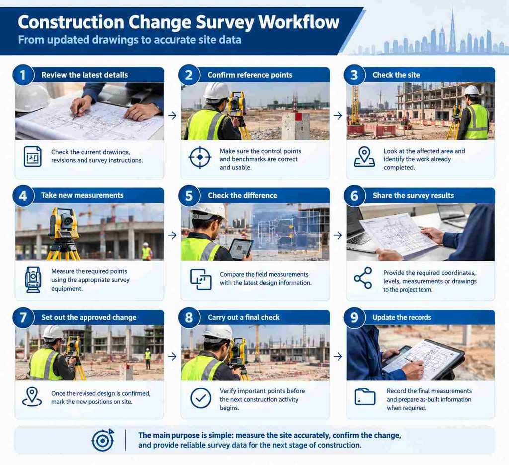
Before measuring a construction change, the surveyor verifies the project’s control points and benchmarks.
Checks may include:
- Coordinates and elevations
- Point stability
- Instrument orientation
- Backsight references
Any disturbed or missing control must be verified before new measurements are tied to the project system.
2. Compare Drawings With Site Conditions
A revised drawing does not necessarily mean the existing construction has changed.
The surveyor compares the current site position with the original and revised design coordinates, including nearby structural and MEP elements. This provides measured information for the project team.
3. Survey Existing Conditions
When a change affects completed or ongoing work, the surveyor may record the current positions of columns, walls, foundations, slabs, openings, drainage features and other elements.
Total Stations, GNSS or 3D laser scanning can be selected according to the feature and required accuracy.
4. Verify Revised Coordinates
Updated coordinates should always be checked against the latest approved drawing revision before field use.
Using coordinates from an outdated revision can result in incorrect setting out, even when the coordinates themselves are mathematically correct.
5. Check Changes in Levels
Changes to floor or ground levels can affect stairs, ramps, drainage, MEP connections and external works.
The surveyor verifies the revised elevation against the project’s established benchmarks and surrounding levels.
6. When Site Conditions Differ From Drawings
If field measurements do not match the drawings, the surveyor records the actual condition and reports the difference.
The engineer, consultant or authorised design team then decides whether a revision, adjustment, investigation or as-built record is required.
7. Managing Revised Setting Out
When a design changes, the survey team works from the latest approved coordinates.
The process may include:
- Checking control
- Confirming revised coordinates
- Setting out the new position
- Checking nearby gridlines
- Recording the change
This prevents old setting-out points from being mistaken for current references.
8. Changes Can Affect Other Trades
A change to a wall, floor level or road edge can affect MEP systems, drainage, utilities and other construction activities.
Accurate survey data helps different teams coordinate their revised work.
9. Using Total Station for Precise Changes
Total Stations are useful for checking:
- Grid intersections
- Column positions
- Wall lines
- Foundation points
- Structural offsets
- Levels
Measured points can be compared with design coordinates to identify deviations.
10. When GNSS Is More Practical
RTK GNSS can be efficient for large, open areas such as earthworks, road corridors and infrastructure sites.
For detailed work around buildings or areas with limited satellite visibility, a Total Station may be more suitable.
11. When 3D Laser Scanning Helps
Complex existing conditions can require more than individual survey points.
3D laser scanning captures dense point-cloud data of structures, MEP services and irregular features, providing detailed information for drawings, models and as-built documentation.
12. Keep the Survey Reference Consistent
Survey data from different construction stages must remain tied to the same reference.
The survey team should maintain:
- Consistent coordinate systems
- Verified control points
- Known benchmarks
- Correct instrument orientation
- Clear field records
- Current design information
13. Verify Before Construction Continues
Critical revised points should be checked before the next construction activity.
Verification can include independent observations, gridline checks, level comparisons and comparison between measured and design coordinates.
14. Record the Final Condition
When approved construction differs from the original design, the final condition may need to be documented through an as-built survey.
The survey records the actual positions, levels and relevant geometry of the completed work for project records, coordination or handover.
Construction Changes and Dubai Surveying Requirements
Surveying for Dubai construction projects follows local regulatory requirements. Dubai Municipality provides regulations for land surveying, building codes and construction-site surveys.
Before design and construction, survey teams may need to check existing buildings, roads, levels and surrounding site conditions. Survey data should therefore match the project’s design, construction and approval requirements.
A Simple Survey Process for Construction Changes
What a Surveyor Should Not Do
A surveyor’s responsibility is measurement and survey control. The surveyor should not independently approve a structural or design change simply because it appears workable in the field.
For example, if a revised column position conflicts with an existing wall, the surveyor can measure and report the conflict.
The structural engineer or authorised design team decides how the conflict should be resolved.
This distinction helps keep the survey data objective and traceable.
Final Thoughts
Construction sites rarely remain exactly as they appeared in the first drawing set. Design revisions, existing-condition differences and coordination changes can all affect the position and level of work.
A surveyor in Dubai helps the project team manage these changes by checking the survey reference, measuring the current site condition, comparing it with the approved information and verifying revised work.
The value is not simply in producing another set of coordinates. It is in keeping the survey information consistent as the project moves from one construction stage to the next.
Need Surveying Support During Construction?
Northern Engineering Surveys L.L.C. provides surveying support for construction and infrastructure projects in Dubai and across the UAE, including Total Station surveys, GNSS/GPS surveying, control-point surveys, setting out, as-built surveys and 3D laser scanning.
If your project has a drawing revision, site discrepancy, level change or construction condition that needs to be measured and verified, the survey team can assess the requirement and select the appropriate survey method.
Contact Northern Engineering Surveys L.L.C. to discuss your construction surveying requirement.
Frequently Asked Questions
1. Why does a surveyor need to revisit a construction site after a design change?
A design revision can affect coordinates, levels, dimensions or relationships with existing work. A site visit allows the surveyor to verify the current physical condition before revised information is set out.
2. What does a surveyor do when the construction site does not match the drawings?
The surveyor measures the actual site condition and reports the difference using coordinates, levels, dimensions or survey drawings. The relevant engineer or consultant then determines the required design or construction response.
3. Can a Total Station be used to check construction changes?
Yes. Total Stations are commonly used for controlled measurements of structural and construction points, including positions, offsets and levels where the required accuracy and site conditions are suitable.
4. When should an as-built survey be carried out?
An as-built survey can be carried out at appropriate construction stages or after completion to document the position, levels and geometry of the work that was actually constructed. The required timing depends on the project and deliverables.
5. What happens if a control point has moved during construction?
The point should not simply be reused. The survey team should verify it against other reliable references and establish or restore the required survey control before continuing with critical measurements.
6. Does every construction change require a new survey?
Not necessarily. The requirement depends on the nature of the change, its effect on coordinates or levels, and the project’s survey and documentation requirements. Changes affecting physical positioning or elevation generally need appropriate field verification.
7. Which surveying equipment can be used when construction changes?
The appropriate equipment depends on the task. Total Stations are useful for controlled point measurements, GNSS for suitable open areas, levels for elevation work, and 3D laser scanners for detailed existing-condition capture.