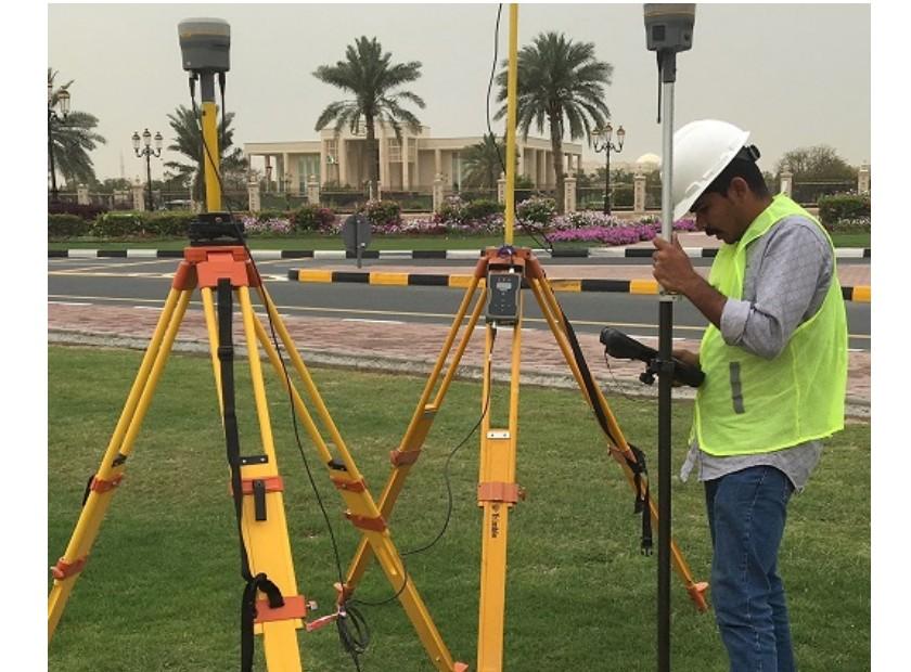
plot survey

Plot Survey Services | Accurate Land Boundary & Topographic Surveys

Professional plot survey services with precise boundary, topographic & legal land surveys using advanced GNSS, total station tech.

Precision Plot Survey Services for Land Planning & Development

Accurate plot surveying is the cornerstone of responsible land development and property planning. Our plot surveys deliver exact boundary identification, topographic detail, and legal demarcation so you can build, subdivide, or transact with confidence. Using advanced GNSS, high-precision total stations, and detailed laser scanning, we capture every critical point on your land with exceptional accuracy. Northern Engineering Survey’s comprehensive plot survey services give you a clear understanding of your property’s limits, features, and potential challenges — helping to avoid disputes, design conflicts, and costly revisions. From initial assessment to certified deliverables, our plot surveys keep your project aligned, compliant, and moving forward smoothly.

Other Related Services

SETTING OUT

Setting Out

Errors in site layout often result in costly rework and delays. Our setting-out services ensure that all elements are precisely positioned using
soil investigation

Soil investigation

Soil testing is essential to determine the load-bearing capacity and stability of the ground for construction. Our soil investigation services
Asbuilt survey

As-Built Survey

Discrepancies between design and construction can cause issues during renovations and operational phases. Our as-built surveys use

Company Profile

Our Business Statistics
Experience
0 +
Projects completed
0 +
Engineers
0 +

Why Choose Us

High-Tech Total
Stations

Utilizing high-precision total stations, we achieve sub-millimeter accuracy with automated measurements and error-free data transfer for reliable, fast setups.

Seamless Data Integration

Our surveying and CAD services integrate flawlessly, ensuring maximum data integrity, eliminating loss, and delivering reliable, accurate results for smooth project execution.

Proven Experience & Expertise

Expertise Northern Engineering Survey boasts a comprehensive portfolio of successful projects, reflecting high client satisfaction and a trusted industry reputation for quality.

Tailored Project Solutions

We offer bespoke solutions supporting precise site planning for construction, land/Environmental assessments, and optimized municipal/urban planning.

Hear From Our Clients

NES Dubai showcases a diverse range of completed projects, indicating their expertise and rel“Professional, Prompt, and Precise!”

Plot Survey FAQ

What is a plot survey and why is it important?

A plot survey is a professional measurement and mapping of a land parcel’s boundaries, dimensions, and physical features. It ensures you know exactly where your property lines lie, helps avoid legal or neighbor disputes, and supports planning, construction, or property transactions.

A plot survey typically includes measuring corner points, boundary lines, and sometimes topographic details (like elevations and features). The surveyor produces a plot survey map or plan showing these measurements visually.

Survey costs vary widely based on plot size, terrain, location, and level of detail required. For basic residential plots, cost can range from moderate to higher depending on complexity and local market conditions.

A licensed plot surveyor uses tools like GPS systems, total stations, or other equipment to measure exact distances, angles, and coordinates. These are then compiled into the plot survey map or plan that shows accurate boundaries and features.

You should order a plot survey before major decisions like buying land, starting construction, subdividing property, or resolving boundary disputes. This helps confirm boundaries and avoid future legal or planning issues.

Scroll to Top