To detect underground utilities, engineers in Dubai use a variety of modern technologies to ensure safety, efficiency, and project success. These tools help create a detailed map of the subsurface, preventing costly damage to pipes and cables. Here are seven of the latest technologies every Dubai engineer should know:
1. Ground Penetrating Radar (GPR)
Ground Penetrating Radar (GPR) is a non-invasive technology that sends high-frequency radio waves into the ground. These waves reflect off buried objects like pipes, cables, and voids. A receiver then captures these reflections, and specialized software translates them into a visual map of the subsurface. GPR is particularly useful because it can detect both metallic and non-metallic utilities, making it a versatile tool for locating plastic pipes and concrete structures that other methods might miss
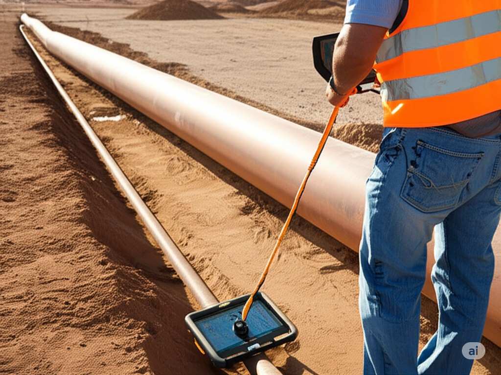
2. Electromagnetic (EM) Locators
Electromagnetic (EM) locators are used to find buried conductive materials, such as metal pipes and power cables. The technology works in two main ways: active and passive modes. In active mode, a transmitter sends a specific frequency signal along a utility line, and a receiver traces the path of that signal. This provides a precise location and depth of the utility. Passive mode, on the other hand, detects existing electromagnetic fields naturally radiated by live power lines or radio signals, which is useful for initial sweeps of an area.
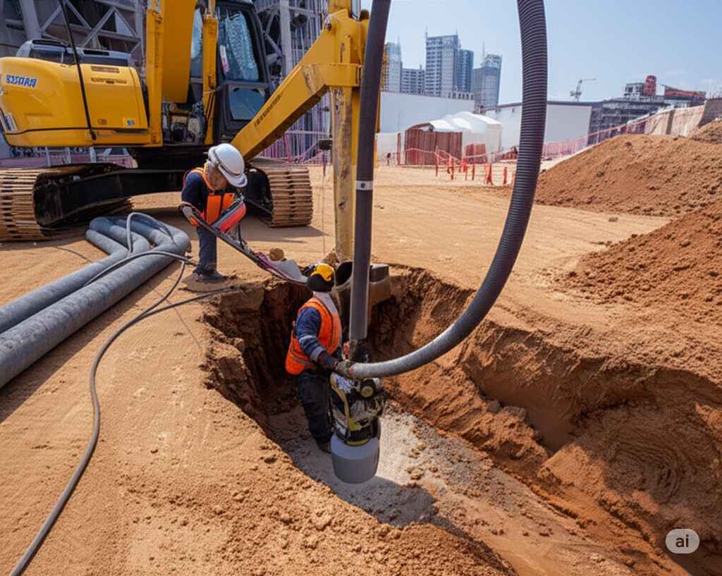
3. Subsurface Utility Engineering (SUE)
Subsurface Utility Engineering (SUE) is a more comprehensive approach rather than a single technology. It’s an engineering practice that involves combining various technologies and data analysis to accurately map underground utilities. SUE categorizes the quality of the collected data into four levels (A, B, C, and D), with Quality Level A providing the highest level of accuracy through vacuum excavation (potholing) to visually confirm the utility’s exact location, type, and depth.
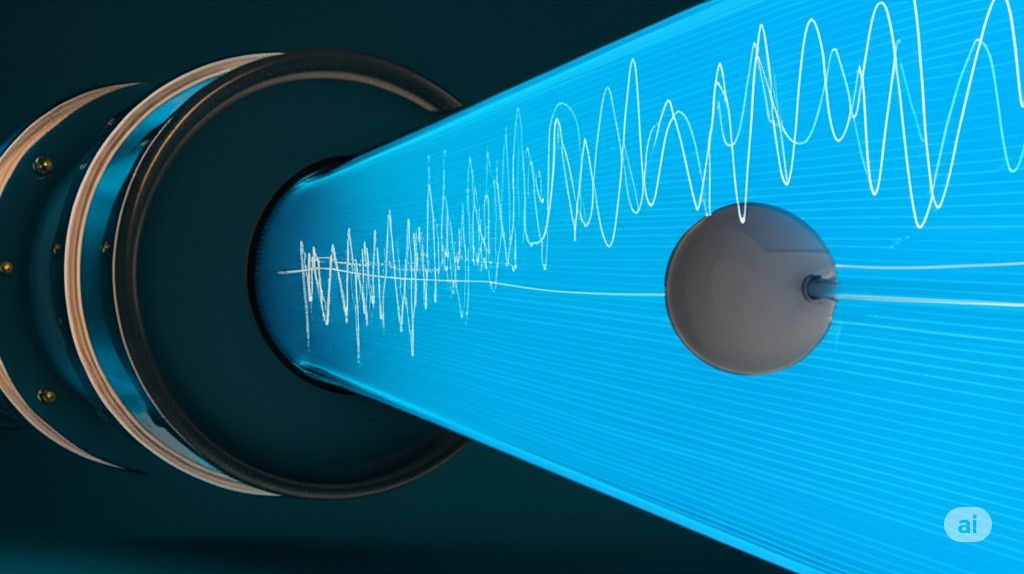
4. Smart Ball Technology
The Smart Ball is an innovative, non-invasive technology specifically used for water pipeline inspection. A small, acoustic sensor-equipped sphere is inserted into a live water pipe, where it travels with the water flow. It listens for the unique sound signatures of leaks. After the Smart Ball is retrieved, the collected data is analyzed using mathematical algorithms to pinpoint the precise location of leaks, saving significant amounts of water and reducing operational costs. The Dubai Electricity and Water Authority (DEWA) has successfully used this technology to detect leaks and reduce water losses.
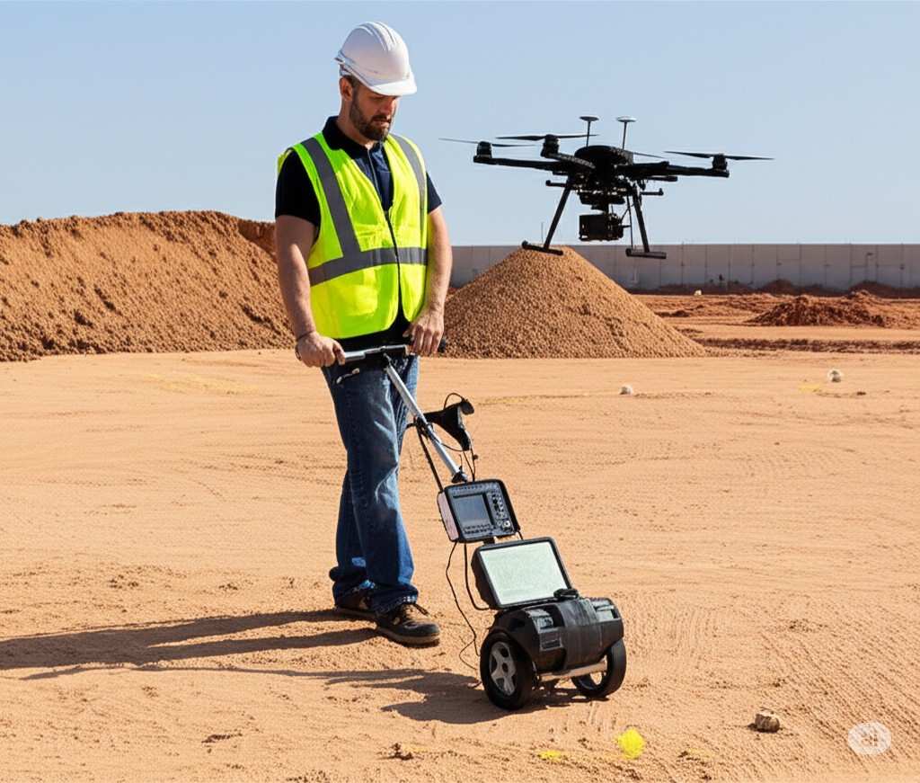
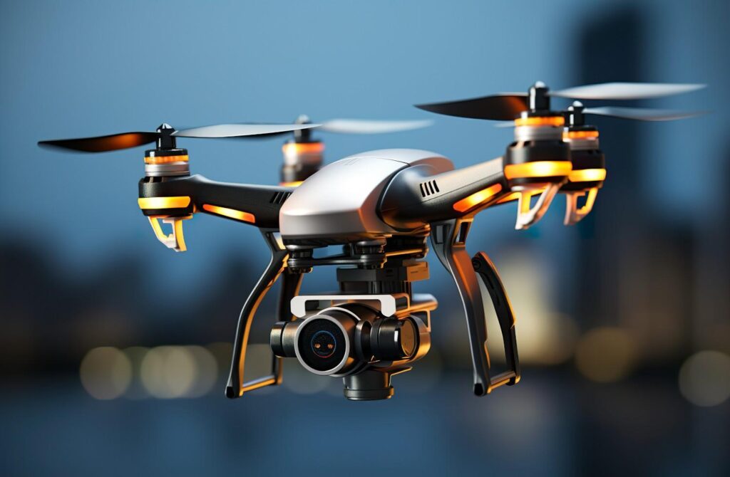
5. Drones with Integrated Sensors
Drones, or Unmanned Aerial Vehicles (UAVs), are increasingly being used in the utility sector for monitoring and inspection. Equipped with advanced sensors like thermal imaging, LiDAR, and high-resolution cameras, drones can inspect vast, difficult-to-reach areas. They can detect leaks in above-ground pipes by identifying temperature anomalies or create detailed 3D models of a site to help in planning and locating surface features that indicate underground utilities.
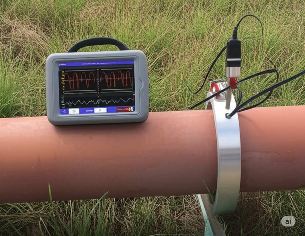
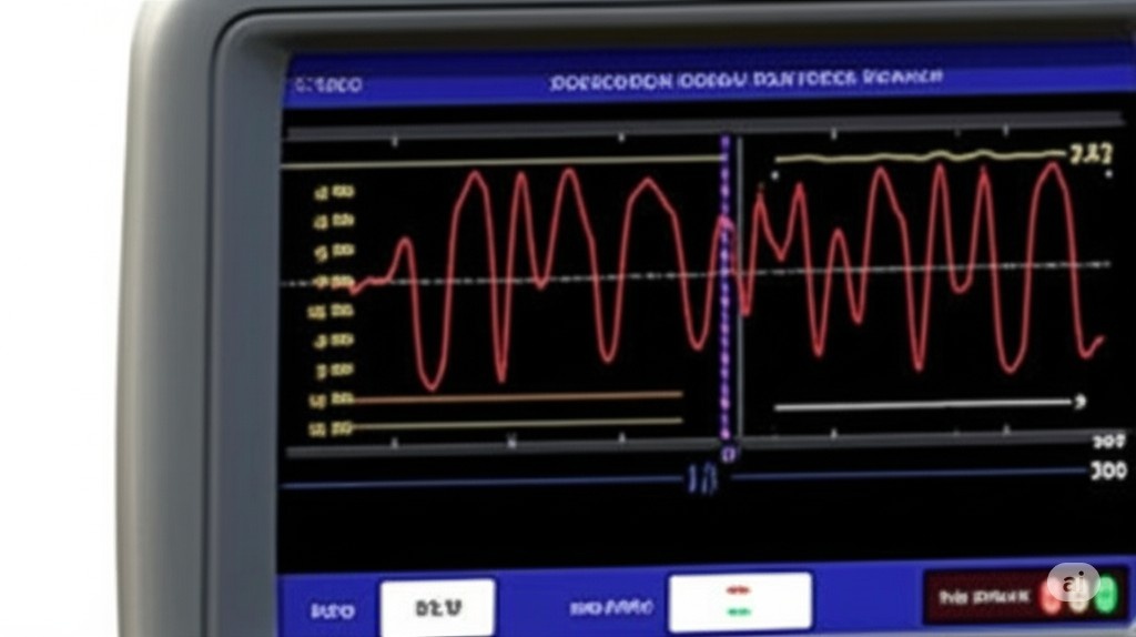
6. Acoustic Inspection Methods
Beyond the Smart Ball, a broader range of acoustic inspection technologies is used to detect leaks and blockages in pipes. These methods work by sending sound waves or vibrations through a pipe and measuring their reflection or attenuation. For example, some systems can identify a leak by listening for the specific frequency it produces, while others can determine the presence of a blockage by analyzing how sound travels through the pipeline. These methods are particularly effective for non-metallic pipes where EM locators don’t work.
7. 3D Utility Mapping and BIM
Modern utility detection is not just about finding a pipe; it’s about creating an accurate, digital record. 3D utility mapping and integrating the data into Building Information Modeling (BIM) systems are crucial. This process combines data from GPR, EM locators, and other tools to create a comprehensive, geo-referenced 3D model of all underground infrastructure. This allows engineers to visualize and analyze the subsurface environment in a detailed and interactive way, preventing conflicts during the design and construction phases of a project.
For professional and precise surveying services, consider partnering with a trusted expert like Northern Engineering Survey Company.