3D Laser Scanning Services Dubai
Get precise 3D data with laser scanning for construction, architecture, and industrial projects. Reduce errors, save time & improve planning.
Scan Everything in Millimeters
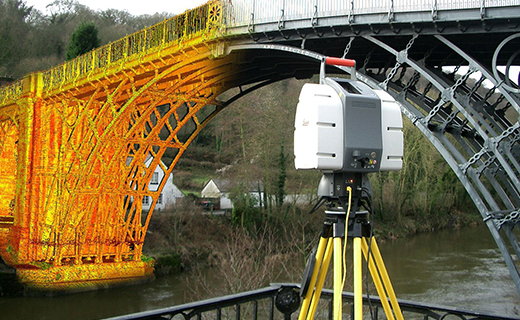
Legacy surveying techniques often fall short due to imprecise data and challenging site conditions. Our cutting-edge 3D laser scanning technology eliminates these issues by providing rapid, precise spatial capture. The result? Safer sites, accurate as-built records, and rich detail for design , analysis and BIM Modeling. Northern Engineering Survey ensures that projects are built on reliable data, reducing rework, speeding up delivery, and enhancing overall project success.

Other Services

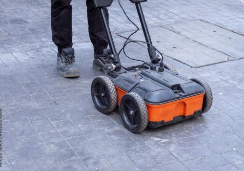
Concrete Scanning

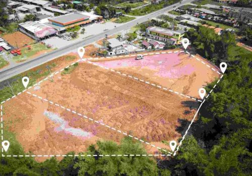
Boundary Survey

As-Built Survey
Company Profile
Our Business Statistics
Why Choose Us
High-Tech Total
Stations
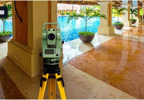
Utilizing high-precision total stations, we achieve sub-millimeter accuracy with automated measurements and error-free data transfer for reliable, fast setups.
Seamless Data Integration
Our surveying and CAD services integrate flawlessly, ensuring maximum data integrity, eliminating loss, and delivering reliable, accurate results for smooth project execution.
Proven Experience & Expertise
Expertise Northern Engineering Survey boasts a comprehensive portfolio of successful projects, reflecting high client satisfaction and a trusted industry reputation for quality.
Tailored Project Solutions
We offer bespoke solutions supporting precise site planning for construction, land/Environmental assessments, and optimized municipal/urban planning.
Hear From Our Clients
NES Dubai showcases a diverse range of completed projects, indicating their expertise and rel“Professional, Prompt, and Precise!”
We’ve worked with NESDubai on multiple residential projects across the UAE. Their consistent quality and use of modern equipment set them apart from other survey firms.
“Trusted Survey Partner for Our Developments” — Omar Khalid, Director.Their BIM modeling and control point services helped us streamline our structural planning process. Communication was clear throughout the project. Will definitely work with them again.
“Highly Accurate and Detailed Surveys” — Lina Haddad, Structural Engineer.From GPS surveys to setting out for our commercial site, NESDubai’s team was on point. Their quick turnaround and technical expertise saved us both time and cost.
.“Reliable, Responsive, and Results-Driven” — James Brooks, Site Manager.3D Laser Scanning Services FAQ
What is 3D Laser Scanning?
It’s a way to quickly and accurately capture the exact 3D shape and size of real-world objects or places using a laser. It creates a “cloud” of millions of tiny points that form a digital copy. This technology delivers highly precise and comprehensive spatial data.
Why use it? What are the benefits?
It’s super accurate, much faster than old methods, and captures a complete picture so you don’t miss anything crucial. This leads to significantly fewer mistakes, enhances safety on site, and ensures quicker project completion. Overall, it boosts efficiency and reliability in your projects.
What projects benefit from 3D Laser Scanning?
Many projects benefit, especially those needing precise “as-built” data for buildings, industrial sites, and infrastructure. It’s ideal for renovations, new construction planning, and any project where highly accurate 3D information is critical for efficiency and success.
How long does a scan take?
The time varies depending on the size of the area and the level of detail needed. Some smaller scans are completed in just minutes, while a very large or complex building might take several days. Regardless, it’s considerably faster than traditional manual surveying methods.
What kind of output can I expect from 3D scanning?
You receive precise digital deliverables, including detailed 2D drawings (like floor plans and sections) and comprehensive 3D models compatible with design software. We also provide raw 3D “point cloud” data and accurate “as-built” plans that show existing conditions.

NES Dubai handled all our demarcation and as-built survey requirements perfectly. Their team was knowledgeable and ensured everything was approved by Dubai Municipality without delays.
“Excellent Service for Construction Permits” — Fatima Al Suwaidi, Architect.